Photo: Wikipedia
Strategic Assessment of Puyallup, WA
Multiple tactical vulnerabilities. Population density, target proximity, or disaster risk are likely compounding. A retreat property and exit planning is required.
What does the Strategic Assessment tell us?
Our Strategic Assessment grades tactical survivability of an area. Major population centers, military targets, fallout zones, natural disasters, and border exposure all drive risk — lower exposure means a more defensible position in a crisis.
This is heavily inspired by Joel Skousen's Strategic Relocation book. Highly recommended you checkout the book ($)What does this tell us?
Our Strategic Assessment grades tactical survivability of an area. Major population centers, military targets, fallout zones, natural disasters, and border exposure all drive risk — lower exposure means a more defensible position in a crisis.
This is heavily inspired by Joel Skousen's Strategic Relocation book. Highly recommended you checkout the book ($)Strategic Pillars

Key Distances
Regional Safe Places
Below is our recommended "safe zones" in Washington and the surrounding area based on our strategic heuristics. For most people, it's unrealistic to live in a “safe zone” full-time due to work, family or other personal reasons. They tend to be more rural. However, many of these areas are perfect for second homes and retreat properties that double as a vacation home or even a short-term rental.


Important Note: For informational purposes only. This does not mean nothing bad ever happens in the green zones. Please use common sense. This is based on public data and modeled with AI. We tried to take a conservative approach but mistakes happen. We update this regularly as new information becomes available.
Solar Generator Recommendations
Backup power matters more here than in safer locations. We've picked three solar generators across budgets and capacity tiers — start with the budget unit if you only need a few essentials, or step up if you want to run a fridge and HVAC for days at a time.

Jackery Portable Power Station Explorer 300
Budget OptionPower on the Go: Weighing only 11 lbs, it's convenient to set up and store with book-sized foldable solar panels

BLUETTI Portable Power Station AC180
Designed for both indoor and outdoor scenarios, AC180 is highly capable as it has a robost capacity and continuous output power.

EF ECOFLOW DELTA Pro Ultra Power Station
Upgraded PickEcoFlow DELTA Pro Ultra is a whole-home energy system designed to grow with your family. Integrated with the Smart Home Panel 2, it scales to meet your evolving energy needs — keeping your home powered, intelligent, and secure through every stage of life.
We earn a commission, at no additional cost to you.
Strategic Assessment Analysis
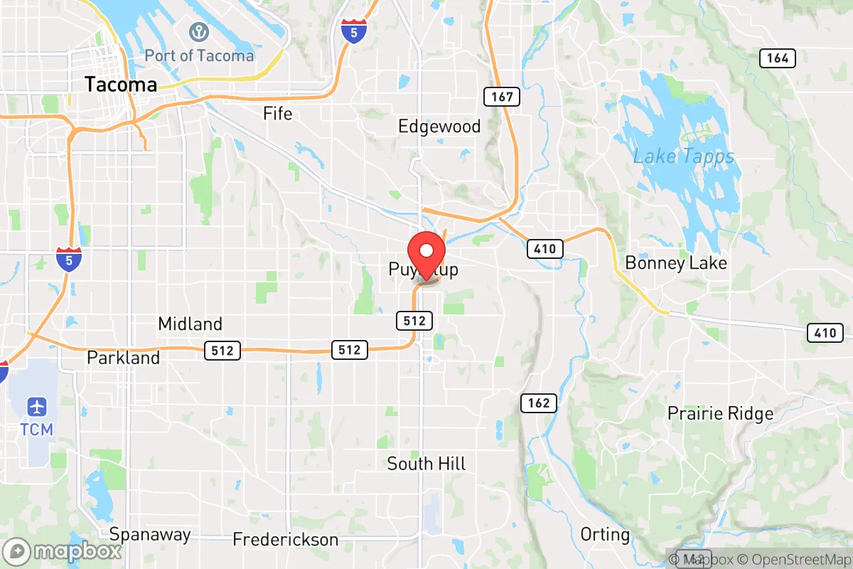
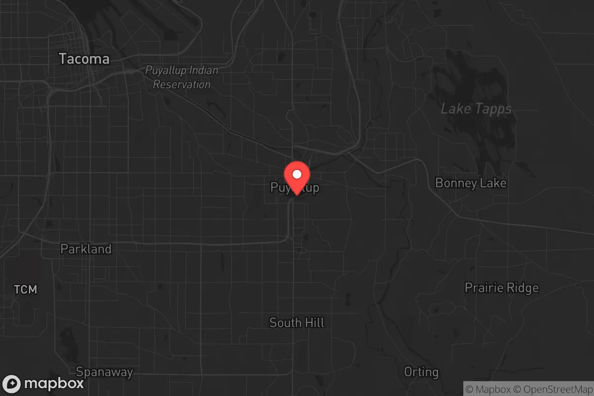
Puyallup, Washington, sits in a precarious but potentially advantageous position for those serious about strategic relocation. Its location at the edge of the Puget Sound megalopolis offers a buffer from the immediate chaos of a major city collapse, while still providing access to critical infrastructure and resources. The area’s resilience is a double-edged sword: the natural geography that makes it a fertile valley also concentrates risk, and its proximity to Joint Base Lewis-McChord (JBLM) means any major military mobilization or civil unrest in the region will ripple through this town first. For a prepper or survivalist, Puyallup is not a bug-out destination—it’s a forward operating base that requires careful planning and a clear-eyed understanding of its vulnerabilities.
Geographic position and natural advantages for long-term survival
Puyallup’s geography is defined by the Puyallup River Valley, which cuts through the Cascade foothills and opens onto the Puget Sound lowlands. This valley provides a natural corridor for movement and resource flow, but it also funnels threats. The surrounding terrain—Mount Rainier to the southeast, the Olympic Mountains to the west, and the Cascade Range to the east—offers multiple escape routes into sparsely populated high country. The area’s abundant rainfall (roughly 40 inches annually) ensures reliable freshwater sources, with the Puyallup River and its tributaries (Carbon, White, and Nisqually rivers) providing year-round flow. For a relocator, this means you can rely on surface water even during drought years, though you’ll need robust filtration given agricultural runoff and potential industrial contamination from upstream. The valley’s fertile soil supports small-scale farming, and the region’s mild winters (average January lows around 34°F) allow for extended growing seasons with cold frames or hoop houses. The key advantage here is defensible terrain: the valley is flanked by steep hillsides and forested ridges, offering natural chokepoints for anyone trying to control access from the north or south. But don’t mistake this for a fortress—the valley floor is a floodplain, and the 2009 floods that swamped parts of Orting and Sumner are a reminder that nature doesn’t care about your preps.
Risks, exposures, and proximity to fallout-relevant landmarks
The biggest strategic liability for Puyallup is its proximity to Joint Base Lewis-McChord (JBLM), located just 15 miles southwest. In a scenario of civil unrest or mass casualty events, JBLM becomes a primary target for both domestic and foreign adversaries. A conventional strike on the base—or even a major accident involving its munitions storage—would generate fallout patterns that could easily drift over the Puyallup Valley depending on prevailing winds. The base also houses the I Corps headquarters, meaning any large-scale military response to a crisis will route through this area, turning local roads into military supply lines and potential ambush zones. Additionally, Puyallup sits within the Mount Rainier lahar hazard zone. The USGS has mapped the Puyallup River valley as a primary lahar path from a potential eruption or landslide, with a flow reaching Puyallup in roughly 2-3 hours. While the lahar risk is low-probability, it’s high-consequence, and the evacuation routes (primarily SR-167 and SR-512) would be gridlocked in a real event. For the conservative-minded relocator, the area’s political vulnerability is also a concern: Pierce County voted 50-47 for Trump in 2020, but Puyallup itself leans more moderate, and the influx of Seattle-area refugees during any crisis could shift local dynamics unpredictably. The Port of Tacoma, just 10 miles north, is a critical logistics hub that would be a target for sabotage or seizure, and its industrial facilities (including oil refineries and chemical storage) create secondary hazards from explosions or toxic releases.
Practical resilience for a relocator: food, water, energy, and defensibility
For a single individual or family looking to establish a resilient foothold, Puyallup offers a mixed bag. Water security is the strongest asset: the Puyallup River is a reliable source, but you’ll need to account for seasonal turbidity and potential contamination from upstream agriculture (dairy farms and berry fields) and the city’s wastewater treatment plant. A good Berkey or Katadyn filter with a pre-filter for sediment is non-negotiable. Food production is viable but requires land—the valley’s soil is rich, but most residential lots in Puyallup proper are small (quarter-acre or less). Look for properties in the surrounding unincorporated areas like Graham or Orting, where you can get 1-5 acres for under $500,000. The local farmers’ markets (Puyallup Farmers Market runs May-October) are a good source for seeds and starter plants, but don’t rely on them in a crisis. Energy independence is challenging here due to the heavy tree cover and frequent cloud cover (Seattle averages 152 cloudy days per year). Solar panels will produce maybe 60-70% of what they’d yield in Arizona, so you’ll need a backup generator or a micro-hydro setup if you have a creek on your property. The grid is relatively stable, but winter storms (like the 2021 ice storm that knocked out power for days) are a recurring threat. Defensibility is the weak point: Puyallup is a suburban bedroom community with no natural defensive perimeter. The valley is wide open, and the main roads (SR-167, SR-512, Meridian Ave) are predictable chokepoints that would be easily blocked. A better strategy is to establish a mutual assistance group with neighbors in a rural pocket like the South Hill area, where the terrain is more rolling and you can create a perimeter with natural barriers (creeks, steep grades). The local gun culture is strong—Pierce County has a high rate of concealed carry permits—so you won’t be alone in your preparations, but that also means you’ll be competing with others for resources during a breakdown.
The overall strategic picture for Puyallup is one of calculated risk. It’s not a survivalist paradise—the proximity to JBLM, the lahar hazard, and the suburban sprawl make it a high-risk area for anyone seeking true isolation. But for the relocator who wants to stay within striking distance of the Pacific Northwest’s resources (timber, fish, fresh water) while maintaining a low profile in a community that still values self-reliance, it’s a viable option. The key is to treat Puyallup as a staging area, not a final destination. Have a bug-out plan for the Cascades or Olympic Peninsula if things go sideways, and invest in community relationships now—the neighbors who know you as the guy with the generator and the extra ammo are the ones who’ll watch your back when the power goes out for good. If you’re looking for a place to ride out the storm without being in the eye of it, Puyallup might work. Just don’t get comfortable.
* Values derived from national, state, county, city and local statistics and may differ in a specific area. Last updated: 2026-04-21T11:00:17.000Z
Narrative content on this page is AI-generated and may contain mistakes. Verify any details that matter before acting on them.
ReloMaps may earn a commission from affiliate links at no extra cost to you.