

Photo: Wikipedia
Strategic Assessment of San Marcos, TX
Meaningful friction. Expect exposure to either population pressure, blast zones, or natural disaster risk. Consider buying a retreat property.
What does the Strategic Assessment tell us?
Our Strategic Assessment grades tactical survivability of an area. Major population centers, military targets, fallout zones, natural disasters, and border exposure all drive risk — lower exposure means a more defensible position in a crisis.
This is heavily inspired by Joel Skousen's Strategic Relocation book. Highly recommended you checkout the book ($)What does this tell us?
Our Strategic Assessment grades tactical survivability of an area. Major population centers, military targets, fallout zones, natural disasters, and border exposure all drive risk — lower exposure means a more defensible position in a crisis.
This is heavily inspired by Joel Skousen's Strategic Relocation book. Highly recommended you checkout the book ($)Strategic Pillars

Key Distances
Regional Safe Places
Below is our recommended "safe zones" in Texas and the surrounding area based on our strategic heuristics. For most people, it's unrealistic to live in a “safe zone” full-time due to work, family or other personal reasons. They tend to be more rural. However, many of these areas are perfect for second homes and retreat properties that double as a vacation home or even a short-term rental.


Important Note: For informational purposes only. This does not mean nothing bad ever happens in the green zones. Please use common sense. This is based on public data and modeled with AI. We tried to take a conservative approach but mistakes happen. We update this regularly as new information becomes available.
Solar Generator Recommendations
Backup power matters more here than in safer locations. We've picked three solar generators across budgets and capacity tiers — start with the budget unit if you only need a few essentials, or step up if you want to run a fridge and HVAC for days at a time.

Jackery Portable Power Station Explorer 300
Budget OptionPower on the Go: Weighing only 11 lbs, it's convenient to set up and store with book-sized foldable solar panels

BLUETTI Portable Power Station AC180
Designed for both indoor and outdoor scenarios, AC180 is highly capable as it has a robost capacity and continuous output power.

EF ECOFLOW DELTA Pro Ultra Power Station
Upgraded PickEcoFlow DELTA Pro Ultra is a whole-home energy system designed to grow with your family. Integrated with the Smart Home Panel 2, it scales to meet your evolving energy needs — keeping your home powered, intelligent, and secure through every stage of life.
We earn a commission, at no additional cost to you.
Strategic Assessment Analysis
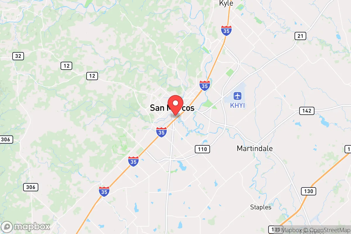
San Marcos, Texas, sits in a precarious but potentially advantageous position for those prioritizing resilience and strategic relocation. Its location along the I-35 corridor between Austin and San Antonio offers a buffer from the immediate fallout of a major urban collapse while still providing access to critical resources, but this same proximity introduces significant vulnerabilities. For a conservative-leaning individual or family focused on preparedness, San Marcos presents a mixed picture: its geographic advantages are real, but the risks tied to its location and infrastructure demand careful, sober assessment.
Geographic position and natural advantages for long-term stability
San Marcos occupies a unique spot in Central Texas, anchored by the Balcones Escarpment and the Edwards Aquifer. The area’s defining natural feature is the San Marcos River, which springs from the aquifer and provides a reliable, year-round water source—a critical asset in drought-prone Texas. The river’s constant flow, fed by the aquifer, means you’re not dependent on surface reservoirs that can dry up or be contaminated. The surrounding Hill Country terrain offers natural defensibility: rolling hills, limestone outcroppings, and dense cedar breaks provide cover and chokepoints for anyone needing to secure a perimeter. The climate is generally mild, with hot summers and cool winters, reducing the strain on shelter and energy needs compared to more extreme regions. The area’s agricultural potential is modest but real—soils along the river bottom are fertile, and the growing season stretches from March to November, allowing for serious gardening or small-scale farming. For a relocator, this means you can establish a semi-self-sufficient homestead within a reasonable distance of the town’s amenities, without being swallowed by suburban sprawl.
Risks, exposures, and proximity to fallout-relevant landmarks
The biggest liability for San Marcos is its position on the I-35 corridor, a major north-south artery that funnels traffic from the border to the interior. In a crisis—whether a natural disaster, grid collapse, or civil unrest—this highway becomes a liability. San Marcos sits less than 30 miles from both Austin and San Antonio, meaning any major event in those cities will send refugees, looters, or military traffic straight through town. The city’s population of roughly 70,000 can swell rapidly with Texas State University’s 38,000 students, creating a dense, transient population that complicates community cohesion and resource allocation. The nearby San Marcos Regional Airport is a small general aviation field, but it’s not a major military or logistics hub—though it could be a target for seizure in a crisis. The area is also within the fallout zone of potential industrial accidents: the Texas Chemical Council lists multiple plants along the Gulf Coast, and while San Marcos is inland, prevailing winds from the southeast could carry airborne contaminants from Houston or Corpus Christi in a worst-case scenario. Flooding is a real, recurring threat—the Blanco River and San Marcos River have both exceeded their banks in recent years, with the 2015 Memorial Day flood causing extensive damage. For a prepper, this means any property must be evaluated for floodplain risk, and evacuation routes need to account for potential road closures.
Practical resilience for a relocator: food, water, energy, and defensibility
Water security is San Marcos’s strongest card. The Edwards Aquifer provides a consistent, high-quality supply, and many rural properties can drill private wells. The San Marcos River itself is a year-round surface water source, but it’s also a public attraction, meaning it will be crowded in a crisis. For a relocator, securing a property with a well or direct river access is non-negotiable. Food resilience is more challenging. The local agricultural scene is dominated by cattle ranching and hay production, but small-scale vegetable farming is viable. The Hays County Farmers Market operates year-round, but it’s not a substitute for personal production. San Marcos has no major grain silos or food processing facilities, so long-term food storage will rely on your own stockpiles. Energy infrastructure is a mixed bag. The city’s grid is part of the ERCOT system, which has proven fragile during winter storms (e.g., 2021’s Winter Storm Uri). Natural gas and propane are available, but solar potential is excellent—Central Texas averages over 200 sunny days per year. For defensibility, the Hill Country terrain offers natural advantages: properties with elevation and limited road access are easier to secure. The local law enforcement presence is modest—Hays County Sheriff’s Office has about 200 deputies for a county of 250,000—so in a prolonged crisis, you’ll largely be on your own. Gun ownership is common and culturally accepted, and Texas’s constitutional carry law means you can defend your property without bureaucratic hurdles. The nearest major medical facility is Central Texas Medical Center in San Marcos, a 102-bed hospital, but for trauma care, you’d need to go to Austin or San Antonio—a 30- to 45-minute drive under normal conditions, potentially impossible during a gridlock.
The overall strategic picture for San Marcos is one of calculated risk. It offers genuine natural advantages—reliable water, defensible terrain, a moderate climate—that make it a viable base for a prepared individual or family. But its location on the I-35 corridor and its proximity to two major cities introduce vulnerabilities that cannot be ignored. San Marcos is not a bug-out location; it’s a live-in location that requires active preparation. You need to harden your property against flooding, secure your own water and energy, and build a community network of like-minded neighbors. The local culture leans conservative, with a strong ranching and outdoor tradition, but the university population injects a liberal, transient element that can create friction. For a relocator willing to invest in infrastructure and maintain a low profile, San Marcos can work. But if you’re looking for a remote, off-grid sanctuary, this isn’t it. It’s a compromise—a place where you can have access to resources and community while still being far enough from the urban core to survive the initial shock of a collapse. The key is to treat it as a base of operations, not a final redoubt. Plan accordingly, and you’ll be ahead of most.
* Values derived from national, state, county, city and local statistics and may differ in a specific area. Last updated: 2026-05-11T20:36:25.000Z
Narrative content on this page is AI-generated and may contain mistakes. Verify any details that matter before acting on them.
ReloMaps may earn a commission from affiliate links at no extra cost to you.