
Photo: Wikipedia
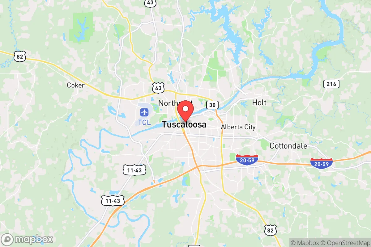
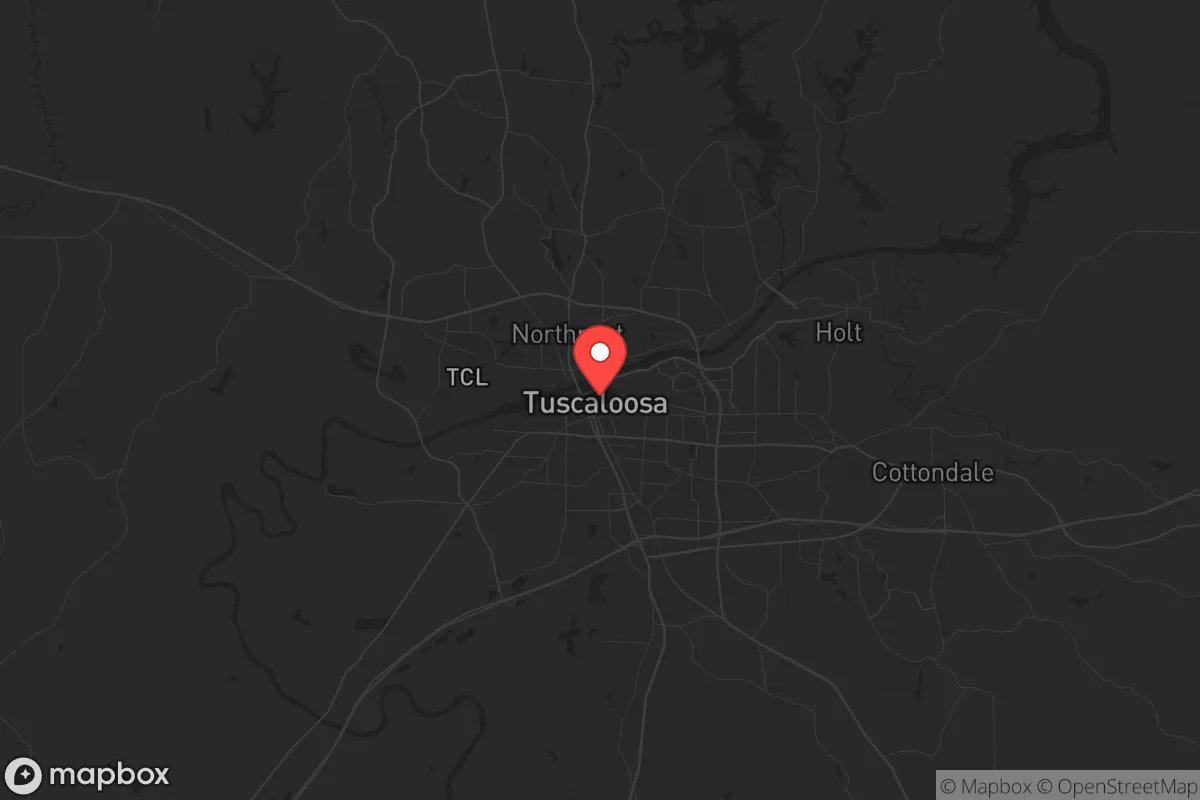
Strategic Assessment of Tuscaloosa, AL
Workable tactical position. Some exposure to population density or targets, but generally defensible in a crisis.
What does the Strategic Assessment tell us?
Our Strategic Assessment grades tactical survivability of an area. Major population centers, military targets, fallout zones, natural disasters, and border exposure all drive risk — lower exposure means a more defensible position in a crisis.
This is heavily inspired by Joel Skousen's Strategic Relocation book. Highly recommended you checkout the book ($)What does this tell us?
Our Strategic Assessment grades tactical survivability of an area. Major population centers, military targets, fallout zones, natural disasters, and border exposure all drive risk — lower exposure means a more defensible position in a crisis.
This is heavily inspired by Joel Skousen's Strategic Relocation book. Highly recommended you checkout the book ($)Strategic Pillars

Key Distances
Regional Safe Places
Below is our recommended "safe zones" in Alabama and the surrounding area based on our strategic heuristics. For most people, it's unrealistic to live in a “safe zone” full-time due to work, family or other personal reasons. They tend to be more rural. However, many of these areas are perfect for second homes and retreat properties that double as a vacation home or even a short-term rental.
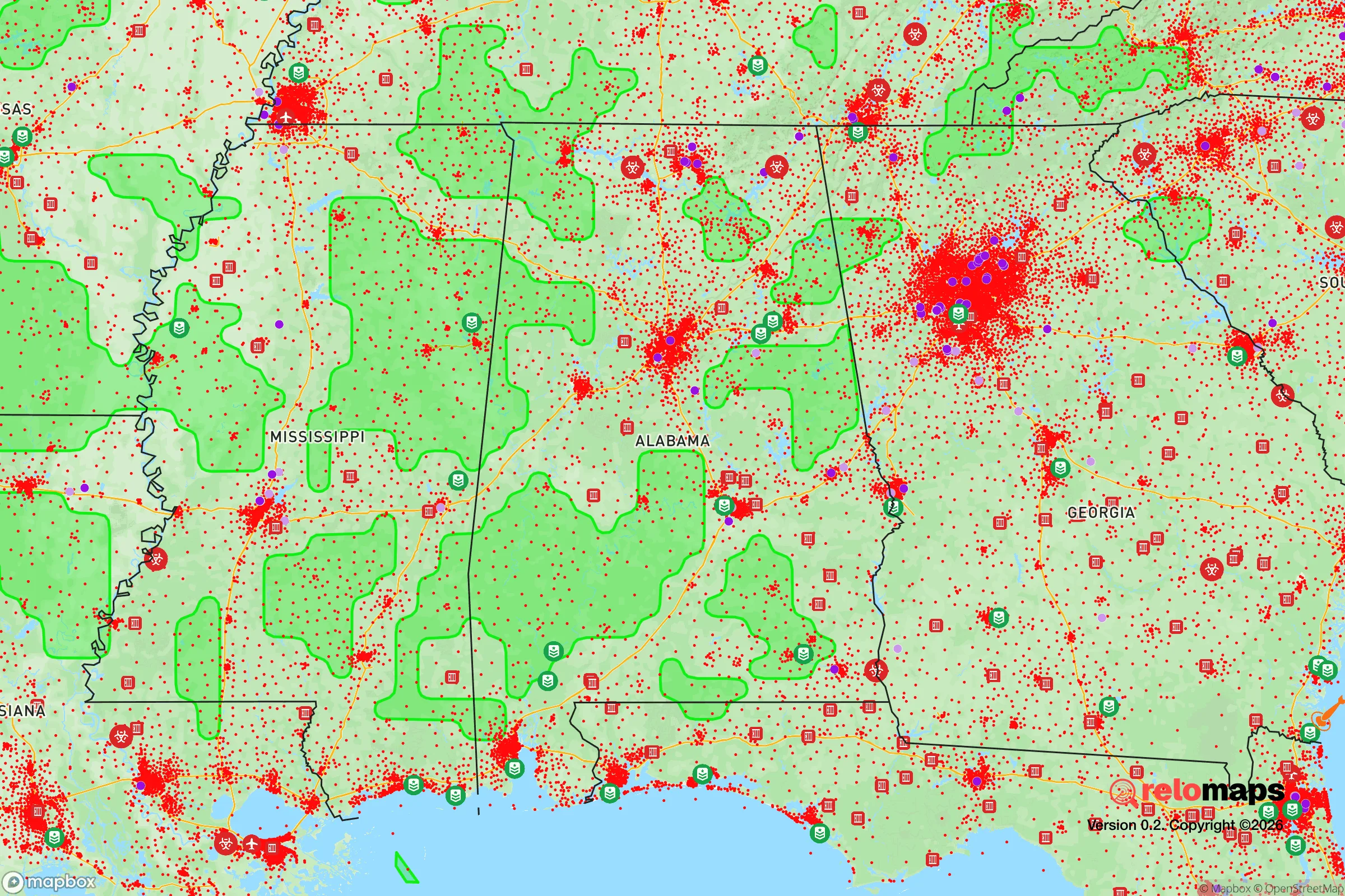
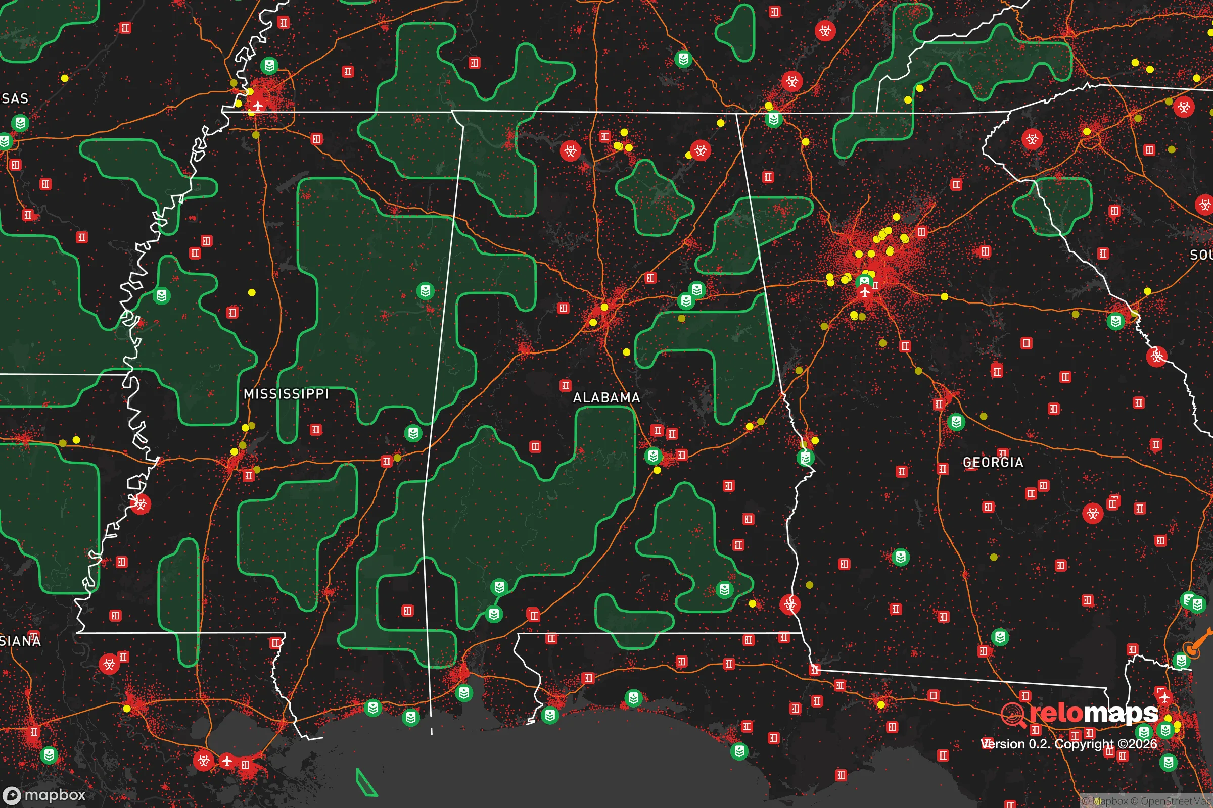
Important Note: For informational purposes only. This does not mean nothing bad ever happens in the green zones. Please use common sense. This is based on public data and modeled with AI. We tried to take a conservative approach but mistakes happen. We update this regularly as new information becomes available.
Solar Generator Recommendations
Backup power matters more here than in safer locations. We've picked three solar generators across budgets and capacity tiers — start with the budget unit if you only need a few essentials, or step up if you want to run a fridge and HVAC for days at a time.

Jackery Portable Power Station Explorer 300
Budget OptionPower on the Go: Weighing only 11 lbs, it's convenient to set up and store with book-sized foldable solar panels

BLUETTI Portable Power Station AC180
Designed for both indoor and outdoor scenarios, AC180 is highly capable as it has a robost capacity and continuous output power.

EF ECOFLOW DELTA Pro Ultra Power Station
Upgraded PickEcoFlow DELTA Pro Ultra is a whole-home energy system designed to grow with your family. Integrated with the Smart Home Panel 2, it scales to meet your evolving energy needs — keeping your home powered, intelligent, and secure through every stage of life.
We earn a commission, at no additional cost to you.
Strategic Assessment Analysis
Tuscaloosa, Alabama, presents a mixed strategic picture for the prepper or survivalist household. Its location along the Black Warrior River and at the intersection of I-20/59 and I-359 offers decent logistical access to the Gulf Coast and the Southeast, but its proximity to Birmingham (roughly 55 miles northeast) and the presence of a major university (University of Alabama, ~38,000 students) introduce significant vulnerabilities. The area’s resilience is anchored in its regional agricultural base and water resources, but the concentration of population, infrastructure, and potential civil unrest vectors makes it a location that requires careful, scenario-specific planning rather than a straightforward relocation recommendation.
Geographic position and natural advantages for long-term survival
Tuscaloosa sits in the Fall Line Hills region of west-central Alabama, a transitional zone between the Appalachian foothills and the Gulf Coastal Plain. This geography provides several natural advantages. The Black Warrior River, a navigable tributary of the Tombigbee River, offers a reliable surface water source and potential transportation corridor for trade or evacuation. The surrounding terrain is hilly and forested, with the Talladega National Forest roughly 40 miles east, providing a buffer zone and potential retreat area. The climate is humid subtropical, with an average annual rainfall of about 54 inches, supporting year-round agriculture and natural water recharge. The growing season is long—typically 220 to 240 days—allowing for substantial food production. The area’s elevation, averaging around 200-300 feet above sea level, mitigates flood risks from the river in most residential zones, though low-lying areas near the river are prone to periodic flooding. The proximity to the Gulf of Mexico (roughly 200 miles south) means hurricane impacts are possible but typically reduced to tropical storm-force winds and heavy rain, not the catastrophic surge seen on the coast. For a relocator, the key natural advantage is water availability and arable land, but the region’s position in the “Dixie Alley” tornado corridor means severe weather is a recurring threat—Tuscaloosa was devastated by an EF4 tornado in April 2011, which killed 64 people and destroyed over 5,000 homes. This is a known, recurring risk that demands robust shelter infrastructure.
Risks, exposures, and proximity to fallout-relevant landmarks
The most significant strategic liability for Tuscaloosa is its proximity to multiple high-value, high-risk targets. Birmingham, with its population of ~200,000 (metro ~1.1 million), is a major industrial, medical, and transportation hub. It hosts the University of Alabama at Birmingham (UAB), a Level I trauma center and research institution, as well as major infrastructure like the Birmingham-Shuttlesworth International Airport and the CSX rail yard. In a scenario involving civil unrest, mass casualty events, or grid-down scenarios, Birmingham would likely become a focal point for chaos, drawing resources and attention. Tuscaloosa is close enough (under an hour by car) to experience spillover effects—refugee flows, resource competition, and potential violence. The University of Alabama campus itself is a concentration of young, transient population, which in a crisis could become a source of instability. The presence of the Mercedes-Benz U.S. International plant (about 15 miles east in Vance) and the Honda Manufacturing of Alabama plant (about 50 miles east in Lincoln) are economic assets but also potential targets for sabotage or supply chain disruption. Additionally, the Browns Ferry Nuclear Plant, located about 40 miles northwest in Limestone County, is a critical infrastructure point. While a catastrophic failure is unlikely, any incident—whether accidental or intentional—could render a large area uninhabitable or subject to evacuation orders. The I-20/59 corridor is a major evacuation route from the Gulf Coast, meaning that in a hurricane or other disaster, Tuscaloosa could see massive traffic congestion and resource strain from coastal evacuees. For the prepper, these proximity risks mean that a Tuscaloosa location requires a strong emphasis on operational security (OPSEC), a well-stocked retreat plan, and the ability to self-sustain for extended periods without reliance on regional supply chains.
Practical resilience for a relocator: food, water, energy, and defensibility
For a household focused on practical resilience, Tuscaloosa offers a mixed bag. Water is a strong point: the Black Warrior River is a perennial source, and the area’s high water table means shallow wells are feasible in many rural parts of the county. The Tuscaloosa Water Works system serves the city, but a prepper should plan for private well or rainwater catchment. Food production is viable: the surrounding counties (Tuscaloosa, Pickens, Greene, Hale) are agricultural, with row crops (corn, soybeans, cotton) and livestock operations. The Tuscaloosa Farmers Market operates year-round, and local food networks exist. However, the soil in the Fall Line Hills is sandy and acidic in many areas, requiring amendment for intensive gardening. Energy is a vulnerability: the grid is served by Alabama Power, a subsidiary of Southern Company, which relies heavily on coal and natural gas. The area is prone to power outages from storms (tornadoes, ice storms, hurricanes). Solar potential is moderate—Alabama averages about 5 peak sun hours per day, but net metering policies are less favorable than in states like Georgia or Florida. Backup generation (propane or diesel) is advisable. Defensibility is the weakest point for urban Tuscaloosa. The city’s layout along the river and major highways creates natural chokepoints and escape routes, but the population density (roughly 100,000 in the city, 230,000 in the county) and the presence of the university make it difficult to secure a perimeter. Rural areas north and east of the city (toward Northport, Coker, or the Sipsey Wilderness) offer better defensibility with larger lots, forested terrain, and fewer neighbors. The local law enforcement presence is the Tuscaloosa Police Department and the Tuscaloosa County Sheriff’s Office, which are professional but would be overwhelmed in a large-scale crisis. The Alabama National Guard has units in the area, but response times in a widespread event would be unpredictable. For a relocator, the optimal strategy is to locate in a rural pocket within 20-30 minutes of the city—close enough for supply runs and medical access, but far enough to avoid the immediate chaos of a population center.
The overall strategic picture for Tuscaloosa is one of calculated risk. It is not a hardened retreat location like the mountainous regions of Montana or Idaho, nor is it a complete vulnerability like a major coastal city. Its strengths—water, agricultural potential, moderate climate, and access to regional resources—are real but offset by significant exposure to tornadoes, proximity to Birmingham and the nuclear plant, and the destabilizing presence of a large university population. For the conservative-leaning prepper who values community, faith, and self-reliance, Tuscaloosa offers a middle ground: a place where you can build a resilient lifestyle if you are intentional about location, infrastructure, and social networks. The key is to avoid the city core and the university zone, invest in tornado shelter and backup power, and establish relationships with like-minded locals before a crisis. If you can secure a property with a well, garden space, and defensible terrain in the surrounding county, Tuscaloosa can work—but it requires active, ongoing preparation, not passive relocation. The area’s history of weathering storms, both literal and figurative, suggests it can endure, but the margin for error is thinner than in more remote, less targeted regions of the country.
* Values derived from national, state, county, city and local statistics and may differ in a specific area. Last updated: 2026-04-19T19:11:40.000Z
Narrative content on this page is AI-generated and may contain mistakes. Verify any details that matter before acting on them.
ReloMaps may earn a commission from affiliate links at no extra cost to you.