Strategic Assessment of Norfolk City County
Multiple tactical vulnerabilities. Population density, target proximity, or disaster risk are likely compounding. A retreat property and exit planning is required.
What does the Strategic Assessment tell us?
Our Strategic Assessment grades tactical survivability of an area. Major population centers, military targets, fallout zones, natural disasters, and border exposure all drive risk — lower exposure means a more defensible position in a crisis.
This is heavily inspired by Joel Skousen's Strategic Relocation book. Highly recommended you checkout the book ($)What does this tell us?
Our Strategic Assessment grades tactical survivability of an area. Major population centers, military targets, fallout zones, natural disasters, and border exposure all drive risk — lower exposure means a more defensible position in a crisis.
This is heavily inspired by Joel Skousen's Strategic Relocation book. Highly recommended you checkout the book ($)Strategic Pillars

Key Distances
Strategic Assessment Analysis
Norfolk City County, Virginia, presents a complex strategic picture for the relocation-minded individual or family. Its core advantage is its position as the world’s largest naval base, which provides an economic anchor and a massive, well-funded infrastructure network, but this same feature makes it a high-priority target in any major conflict. For a reader prioritizing disaster readiness and self-sufficiency, the area offers a mix of robust logistical resilience and significant, non-negotiable exposure to man-made risks that must be weighed carefully.
Geographic position and natural advantages for long-term stability
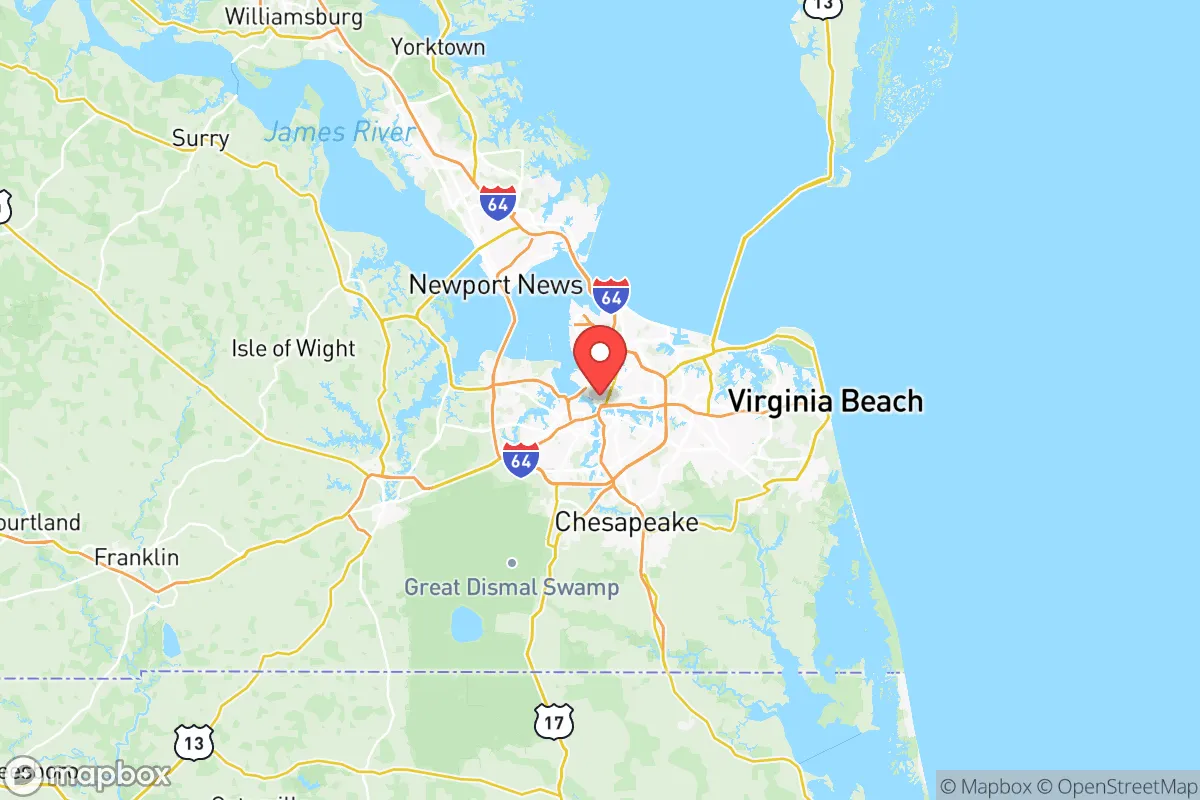
Norfolk sits at the mouth of the Chesapeake Bay, a location that has defined its strategic importance for centuries. The city is part of the Hampton Roads metropolitan area, which includes Virginia Beach, Chesapeake, Newport News, and Hampton. The area’s natural harbor is one of the finest on the East Coast, protected from the open Atlantic by the Virginia Capes (Cape Henry and Cape Charles). This geography provides a natural buffer against the worst of hurricane storm surge, though it is by no means immune. The region’s water table is high, and the land is generally flat, which limits options for underground bunkering or deep well drilling but makes surface water access straightforward. The nearby Great Dismal Swamp and the Dismal Swamp Canal offer a secondary waterway route and a significant natural barrier to the south, while the James River to the west provides a major freshwater source. For a relocator, the key natural advantage is the sheer volume of water—both fresh and salt—which can support fishing, transport, and basic survival needs if conventional systems fail. The climate is humid subtropical, with mild winters and hot, humid summers, which supports year-round gardening but also brings a persistent risk of tropical storms and nor’easters.
Risks, exposures, and proximity to fallout-relevant landmarks
The single greatest risk in Norfolk is its role as the home of Naval Station Norfolk, the largest naval base in the world. This installation is a primary target for any adversary with long-range strike capability. Within a 10-mile radius of downtown Norfolk, you also find Naval Air Station Oceana in Virginia Beach, Joint Base Langley-Eustis in Hampton (home to Air Combat Command and the 633rd Air Base Wing), and the Norfolk Naval Shipyard in Portsmouth. These are not just military bases; they are command-and-control nodes for the entire Atlantic Fleet. A single high-yield conventional or nuclear strike on this complex would effectively cripple U.S. naval power on the East Coast. The fallout plume from such an event would blanket much of Norfolk, Portsmouth, Chesapeake, and Virginia Beach, depending on wind direction. Additionally, the Port of Virginia in Norfolk is one of the busiest on the Eastern Seaboard, handling massive container traffic and serving as a critical logistics hub. In a crisis, this port would be a choke point for military resupply and a likely target for sabotage or attack. The area also has significant industrial infrastructure, including the Kinder Morgan Norfolk Terminal for petroleum storage and the Dominion Energy Yorktown Power Station (a natural gas plant) just up the James River. For a relocator, the proximity to these high-value, high-risk assets means that any major conflict would render Norfolk uninhabitable for an extended period. Natural risks are secondary but real: the region is vulnerable to hurricanes (Category 2 or 3 storms are a recurring threat), flooding from heavy rain and storm surge, and occasional tornadoes. The city’s low elevation and extensive impervious surfaces mean that even a moderate rain event can cause street flooding.
Practical resilience for a relocator: food, water, energy, and defensibility
On the practical side, Norfolk has some genuine resilience strengths. The city’s water supply comes from the Lake Gaston Regional Water Supply Project, a pipeline that draws from Lake Gaston on the Virginia-North Carolina border, about 80 miles west. This source is less vulnerable to saltwater intrusion or local contamination than the James River or local aquifers. For a relocator, this means that even if local treatment plants are damaged, the raw water source is relatively secure. Food resilience is moderate: the region has a strong agricultural hinterland in southeastern Virginia and northeastern North Carolina, with farms producing soybeans, corn, peanuts, and livestock. The Norfolk Farmers Market and local CSAs provide some local food access, but the city itself is heavily dependent on trucked-in supplies via Interstates 64, 264, and 464. In a prolonged disruption, these highways would be clogged with military and emergency traffic. Energy resilience is a mixed bag. Dominion Energy’s grid is reliable under normal conditions, but the area is at the end of a long transmission corridor from power plants in central Virginia and western North Carolina. The Surry Nuclear Power Plant is about 30 miles northwest, which provides a stable baseload but also represents another potential target. For a relocator, solar panels with battery storage are a viable option, as the region gets about 200 sunny days per year. Defensibility is the weakest point. Norfolk is a dense, urbanized city with a population of about 240,000 within the city limits and over 1.7 million in the metro area. The flat, open terrain offers no natural defensive positions. The city is crisscrossed by waterways, bridges, and tunnels—the Hampton Roads Bridge-Tunnel and the Monitor-Merrimac Memorial Bridge-Tunnel are critical chokepoints that would be easily blocked or destroyed. In a collapse scenario, Norfolk would be a difficult place to hold or evacuate from. The best strategy for a relocator is to have a pre-planned bug-out route west, toward the higher ground and more rural areas of Isle of Wight County, Southampton County, or even into North Carolina’s Roanoke River valley.
The overall strategic picture for Norfolk City County is one of high reward paired with extreme risk. The economic opportunities tied to the military and port are unmatched in the region, and the area’s infrastructure is robust by American standards. However, for a reader focused on disaster readiness and self-sufficiency, the concentration of high-value military and industrial targets makes Norfolk a place to avoid as a primary residence. It is a city that will be defended at all costs by the federal government, which means it will also be attacked at all costs by any capable adversary. A more prudent approach for the conservative-leaning relocator would be to locate in a smaller, less critical town within a 60- to 90-minute drive—such as Smithfield or Franklin—where you can access Norfolk’s economic and medical resources in peacetime but have a defensible, low-profile retreat when the situation deteriorates. Norfolk itself is not a survival location; it is a strategic liability that demands a clear exit plan.

* Values derived from national, state, county, city and local statistics and may differ in a specific area. Last updated: 2026-08-25T02:10:12.000Z
Narrative content on this page is AI-generated and may contain mistakes. Verify any details that matter before acting on them.
ReloMaps may earn a commission from affiliate links at no extra cost to you.

