

Photo: Wikipedia
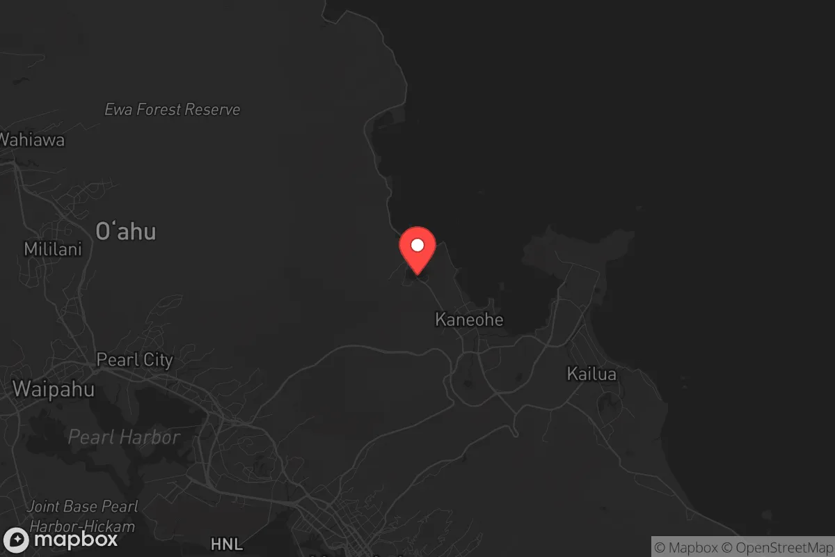
Strategic Assessment of Ahuimanu, HI
Meaningful friction. Expect exposure to either population pressure, blast zones, or natural disaster risk. Consider buying a retreat property.
What does the Strategic Assessment tell us?
Our Strategic Assessment grades tactical survivability of an area. Major population centers, military targets, fallout zones, natural disasters, and border exposure all drive risk — lower exposure means a more defensible position in a crisis.
This is heavily inspired by Joel Skousen's Strategic Relocation book. Highly recommended you checkout the book ($)What does this tell us?
Our Strategic Assessment grades tactical survivability of an area. Major population centers, military targets, fallout zones, natural disasters, and border exposure all drive risk — lower exposure means a more defensible position in a crisis.
This is heavily inspired by Joel Skousen's Strategic Relocation book. Highly recommended you checkout the book ($)Strategic Pillars

Key Distances
Regional Safe Places
Below is our recommended "safe zones" in Hawaii and the surrounding area based on our strategic heuristics. For most people, it's unrealistic to live in a “safe zone” full-time due to work, family or other personal reasons. They tend to be more rural. However, many of these areas are perfect for second homes and retreat properties that double as a vacation home or even a short-term rental.


Important Note: For informational purposes only. This does not mean nothing bad ever happens in the green zones. Please use common sense. This is based on public data and modeled with AI. We tried to take a conservative approach but mistakes happen. We update this regularly as new information becomes available.
Solar Generator Recommendations
Backup power matters more here than in safer locations. We've picked three solar generators across budgets and capacity tiers — start with the budget unit if you only need a few essentials, or step up if you want to run a fridge and HVAC for days at a time.

Jackery Portable Power Station Explorer 300
Budget OptionPower on the Go: Weighing only 11 lbs, it's convenient to set up and store with book-sized foldable solar panels

BLUETTI Portable Power Station AC180
Designed for both indoor and outdoor scenarios, AC180 is highly capable as it has a robost capacity and continuous output power.

EF ECOFLOW DELTA Pro Ultra Power Station
Upgraded PickEcoFlow DELTA Pro Ultra is a whole-home energy system designed to grow with your family. Integrated with the Smart Home Panel 2, it scales to meet your evolving energy needs — keeping your home powered, intelligent, and secure through every stage of life.
We earn a commission, at no additional cost to you.
Strategic Assessment Analysis
Ahuimanu, tucked into the windward side of Oahu, offers a rare combination of geographic isolation and practical defensibility that makes it a serious contender for those prioritizing long-term resilience. While the island of Oahu as a whole faces obvious constraints—finite land, a single major port, and heavy dependence on imported goods—Ahuimanu’s specific position along the Koolau mountain range provides natural barriers that most Honolulu suburbs simply lack. For a relocator thinking in terms of decades, not months, this area’s ability to buffer against both natural disasters and civil unrest is worth a hard look, especially when compared to the dense, exposed corridors of Waikiki or Pearl City.
Geographic position and natural advantages for long-term security
Ahuimanu sits roughly 12 miles northeast of downtown Honolulu, but the drive feels like crossing into a different world. The town is wedged between the Koolau cliffs to the west and Kaneohe Bay to the east, creating a natural funnel that limits access points. This is a double-edged sword—it makes ingress and egress predictable—but for someone concerned with perimeter security, it’s a significant asset. The surrounding mountains rise sharply to over 2,000 feet, providing rain shadow effects that keep Ahuimanu greener and cooler than leeward areas. Annual rainfall here averages around 70 inches, which is a blessing for water catchment but a challenge for drainage. The soil is volcanic and fertile, supporting small-scale agriculture that could supplement food supplies in a grid-down scenario. The nearby Ho’omaluhia Botanical Garden, a 400-acre reserve, doubles as a potential foraging and water source, though it’s managed by the city and could become contested in a crisis.
Risks, exposures, and proximity to fallout-relevant landmarks
The elephant in the room is Oahu’s concentration of strategic targets. Pearl Harbor, Hickam Air Force Base, and Joint Base Pearl Harbor-Hickam are all within 15 miles as the crow flies. In a conflict scenario—whether conventional or asymmetric—these are high-value targets. Ahuimanu’s position behind the Koolau range offers some shielding from blast effects and fallout, but prevailing trade winds blow from the northeast, meaning any airborne contamination from a strike on the harbor could drift toward windward communities. The H-3 freeway, which cuts through the mountains and connects Ahuimanu to Pearl Harbor, is a critical evacuation route but also a choke point that could be blocked by debris or civil unrest. The nearby Kaneohe Marine Corps Base is another potential target, though smaller in scale. For a prepper, the takeaway is clear: Ahuimanu is not a fallout-free zone, but its topography provides more buffer than any flatland suburb. The real risk is not a direct hit but the cascading effects—panic-driven migration from Honolulu, supply chain collapse, and the breakdown of civil order in a population of nearly a million people just over the hill.
Practical resilience for a relocator: food, water, energy, and defensibility
Water is the strongest card Ahuimanu holds. The area sits atop a basal aquifer, and many older homes already have catchment systems or wells. The consistent rainfall means that even without municipal supply, a household with proper storage and filtration can maintain a reliable water source. The city’s Board of Water Supply maintains reservoirs in the Koolaus, but those are vulnerable to contamination and infrastructure failure. For a relocator, investing in a 5,000-gallon catchment tank and a UV filtration system is non-negotiable. Food is trickier. The soil is rich, but the climate’s humidity and pests make long-term storage of dry goods a challenge. Local farmers markets in Kaneohe and Kailua offer fresh produce, but these are luxury goods in normal times and would vanish quickly in a crisis. A serious prepper would need to establish a greenhouse, root cellar, and a network of trade with windward farmers. Energy is a mixed bag. Solar potential is lower than on the leeward side due to cloud cover, but still viable with modern panels. Battery storage is essential, as grid outages are common during storms. The HECO grid on windward Oahu is aging and prone to failure; a 10kW solar array with 20kWh of battery backup is the baseline for any serious off-grid capability. Defensibility is where Ahuimanu shines. The limited road access—primarily Kahekili Highway and the H-3—means that a small group could monitor and control movement into the area. The terrain is rugged, with dense vegetation and steep slopes that make foot travel off-road difficult. Neighbors here tend to be long-term residents, many of whom are military or ex-military, which creates a community that understands security. That said, the population is still around 8,000, and in a collapse scenario, that’s 8,000 mouths to feed. A relocator should aim for a property with a defensible perimeter—fenced, with clear sightlines—and avoid homes directly on the main roads.
The overall strategic picture for Ahuimanu is one of calculated trade-offs. It offers genuine natural advantages in water, terrain, and isolation that are rare on Oahu, and it’s far enough from the urban core to avoid the worst of civil unrest in the early stages of a crisis. But it is not a bug-out location in the mainland sense—there is no second horizon to retreat to, no vast hinterland. The island’s dependence on imported fuel, food, and medicine means that any prolonged disruption will hit hard, and Ahuimanu will feel it just as much as Honolulu, only a few days later. For a conservative-minded relocator who values community cohesion, self-sufficiency, and a defensible position, Ahuimanu is a strong candidate—but only if paired with serious preparation, a willingness to invest in infrastructure, and a clear-eyed understanding that no place in Hawaii is truly remote. The mountains will buy you time, not safety. Use it wisely.
* Values derived from national, state, county, city and local statistics and may differ in a specific area. Last updated: 2026-05-04T03:00:12.000Z
Narrative content on this page is AI-generated and may contain mistakes. Verify any details that matter before acting on them.
ReloMaps may earn a commission from affiliate links at no extra cost to you.