
Photo: Wikipedia
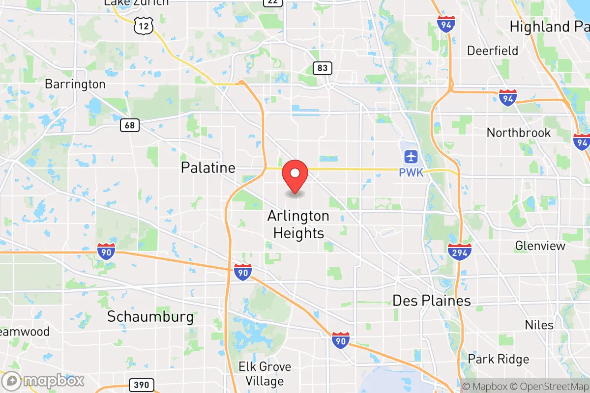
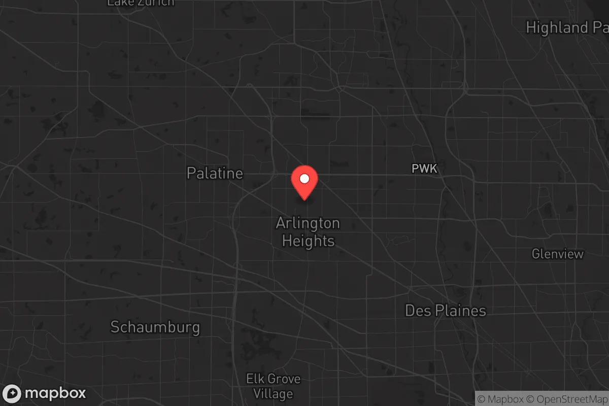
Strategic Assessment of Arlington Heights, IL
Multiple tactical vulnerabilities. Population density, target proximity, or disaster risk are likely compounding. A retreat property and exit planning is required.
What does the Strategic Assessment tell us?
Our Strategic Assessment grades tactical survivability of an area. Major population centers, military targets, fallout zones, natural disasters, and border exposure all drive risk — lower exposure means a more defensible position in a crisis.
This is heavily inspired by Joel Skousen's Strategic Relocation book. Highly recommended you checkout the book ($)What does this tell us?
Our Strategic Assessment grades tactical survivability of an area. Major population centers, military targets, fallout zones, natural disasters, and border exposure all drive risk — lower exposure means a more defensible position in a crisis.
This is heavily inspired by Joel Skousen's Strategic Relocation book. Highly recommended you checkout the book ($)Strategic Pillars

Key Distances
Regional Safe Places
Below is our recommended "safe zones" in Illinois and the surrounding area based on our strategic heuristics. For most people, it's unrealistic to live in a “safe zone” full-time due to work, family or other personal reasons. They tend to be more rural. However, many of these areas are perfect for second homes and retreat properties that double as a vacation home or even a short-term rental.
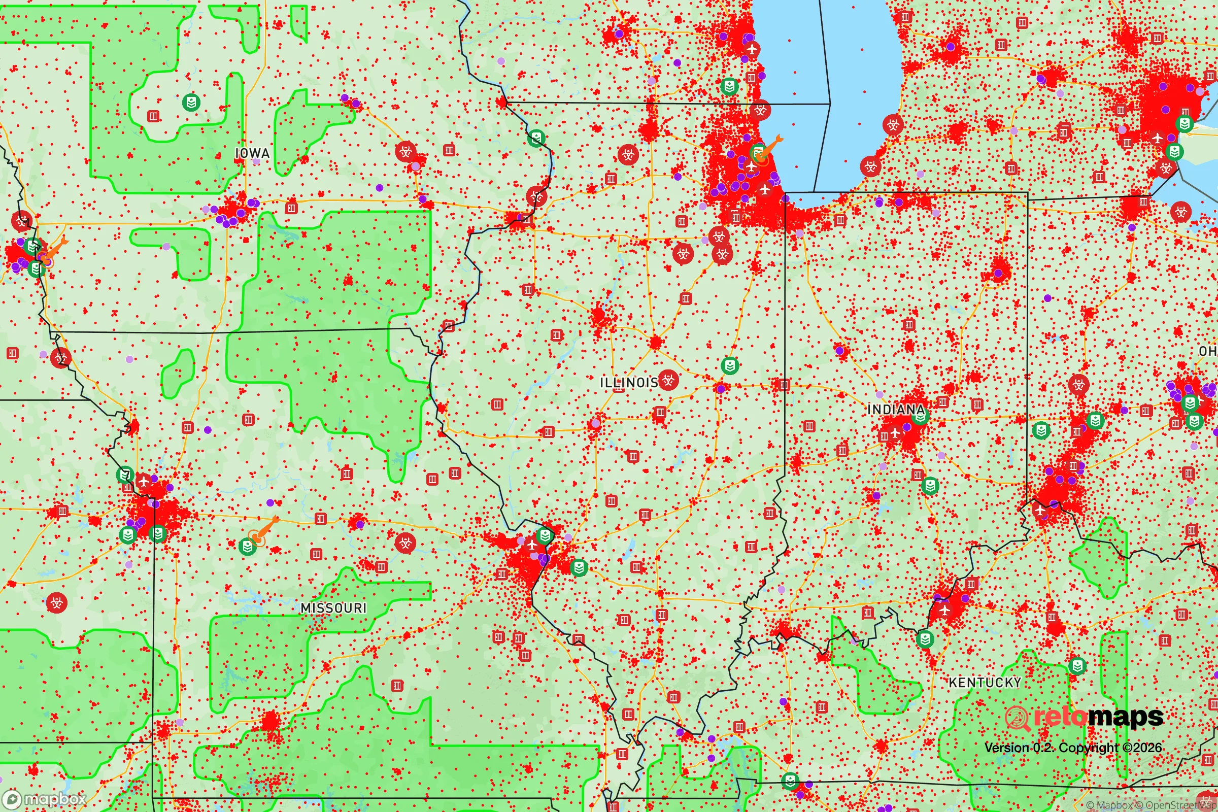
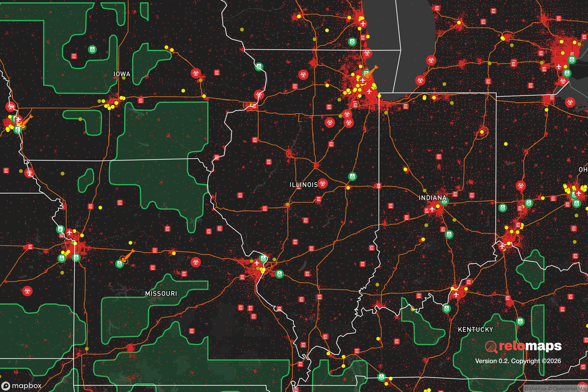
Important Note: For informational purposes only. This does not mean nothing bad ever happens in the green zones. Please use common sense. This is based on public data and modeled with AI. We tried to take a conservative approach but mistakes happen. We update this regularly as new information becomes available.
Solar Generator Recommendations
Backup power matters more here than in safer locations. We've picked three solar generators across budgets and capacity tiers — start with the budget unit if you only need a few essentials, or step up if you want to run a fridge and HVAC for days at a time.

Jackery Portable Power Station Explorer 300
Budget OptionPower on the Go: Weighing only 11 lbs, it's convenient to set up and store with book-sized foldable solar panels

BLUETTI Portable Power Station AC180
Designed for both indoor and outdoor scenarios, AC180 is highly capable as it has a robost capacity and continuous output power.

EF ECOFLOW DELTA Pro Ultra Power Station
Upgraded PickEcoFlow DELTA Pro Ultra is a whole-home energy system designed to grow with your family. Integrated with the Smart Home Panel 2, it scales to meet your evolving energy needs — keeping your home powered, intelligent, and secure through every stage of life.
We earn a commission, at no additional cost to you.
Strategic Assessment Analysis
Arlington Heights, Illinois, presents a complex strategic picture for the conservative-leaning relocator who prioritizes resilience. While its location offers genuine advantages in terms of infrastructure and community stability, its proximity to Chicago and key geopolitical targets introduces significant risks that cannot be ignored. For the single individual or family preparing for civic unrest, mass casualty events, or large-scale disasters, this suburb is best understood as a high-functioning buffer zone—close enough to benefit from resources, but dangerously close to the epicenter of potential fallout.
Geographic position and natural advantages for long-term stability
Arlington Heights sits roughly 25 miles northwest of downtown Chicago, placing it in a sweet spot for those who want access to urban economic engines without being in the blast radius of a worst-case scenario. The area is part of the Cook County suburban ring, but it benefits from a relatively stable grid of roads, rail, and utilities. The village is served by Metra’s Union Pacific Northwest Line, which offers a direct evacuation route north toward Wisconsin if needed—a critical detail for anyone mapping egress paths. The terrain is flat, which limits natural defensibility, but the region’s deep soil and abundant groundwater (via the Lake Michigan aquifer and local wells) provide a reliable water source that many other suburbs cannot claim. The area’s tree cover and established residential lots offer some visual screening, though not the kind of rugged cover you’d find in hill country. For a prepper, the key natural advantage here is the proximity to Lake Michigan—a massive, renewable freshwater source that could sustain a community through prolonged disruptions, provided you have the means to filter and transport it.
Risks, exposures, and proximity to fallout-relevant landmarks
This is where the analysis gets sobering. Arlington Heights is within 30 miles of O’Hare International Airport, one of the busiest air hubs in the world and a high-value target for any state-level adversary. It is also within 35 miles of the Argonne National Laboratory in Lemont, a nuclear research facility that, while secure, represents a potential radiological hazard in a major event. The village itself sits near the intersection of several major highways (I-90, I-294, and Route 53), which are evacuation corridors but also choke points that could become impassable during a panic. The biggest strategic liability is the density of the Chicago metropolitan area. In a mass casualty event or civil unrest scenario, Arlington Heights would likely see a surge of refugees from the city, overwhelming local resources. The village’s police force is competent but small—around 100 sworn officers for a population of 75,000—meaning that in a breakdown of order, residents would largely rely on themselves and their immediate neighbors. Additionally, the area’s reliance on the electrical grid and natural gas pipelines (both vulnerable to cyberattack or physical sabotage) means that a prolonged power outage would hit hard. There are no major military installations nearby to provide a security buffer, and the closest National Guard assets are in Chicago and North Riverside, which could be delayed or diverted in a crisis.
Practical resilience for a relocator: food, water, energy, and defensibility
For the individual or family looking to hunker down, Arlington Heights offers a mixed bag. On the positive side, the village has a robust network of grocery stores, hardware outlets, and medical facilities (including Northwest Community Hospital, a Level II trauma center) that would be critical in the first 72 hours of a disaster. However, food storage is a challenge in typical suburban homes, which lack the root cellars or deep pantries common in rural properties. Most homes here are built on concrete slabs or with basements that are prone to flooding in heavy rain, so long-term dry storage requires careful planning. Water is less of a concern if you have a filtration system and access to Lake Michigan or the Des Plaines River (about 5 miles west), but both sources require treatment for pathogens and industrial runoff. Energy resilience is the weak link. The grid is reliable day-to-day but brittle under stress; a solar panel setup with battery backup is advisable, but homeowners associations (HOAs) in some parts of Arlington Heights may restrict visible installations. Natural gas generators are common but depend on pipeline integrity. Defensibility is poor by design—the village is a grid of cul-de-sacs and arterial roads, with no natural chokepoints. Neighborhood watch and mutual-aid networks are the only realistic defense against looting or roaming groups, and these require advance organization. For the prepper, the best strategy is to treat Arlington Heights as a staging ground rather than a final redoubt: stock supplies, build relationships with like-minded neighbors, and have a bug-out plan for rural Wisconsin or Michigan if the situation deteriorates beyond local control.
The overall strategic picture for Arlington Heights is one of calculated risk. It offers the economic and social stability that conservative families value—good schools, low violent crime rates relative to Chicago, and a community that largely respects property rights and local governance. But it sits in the shadow of a major city that could become a liability in a national crisis. For the relocator who is serious about preparedness, this suburb demands a proactive mindset: invest in off-grid capabilities, build a local network of trusted contacts, and maintain a low profile. It is not a survivalist paradise, but it is a place where a disciplined, resourceful family can weather many storms—provided they have the foresight to prepare before the sirens sound. If you are looking for a location that balances daily quality of life with a reasonable chance of riding out a disaster, Arlington Heights is worth a hard look. Just don’t mistake its suburban calm for true security.
* Values derived from national, state, county, city and local statistics and may differ in a specific area. Last updated: 2026-04-24T16:44:11.000Z
Narrative content on this page is AI-generated and may contain mistakes. Verify any details that matter before acting on them.
ReloMaps may earn a commission from affiliate links at no extra cost to you.