
Photo: Wikipedia
Strategic Assessment of Blackfoot, ID
Workable tactical position. Some exposure to population density or targets, but generally defensible in a crisis.
What does the Strategic Assessment tell us?
Our Strategic Assessment grades tactical survivability of an area. Major population centers, military targets, fallout zones, natural disasters, and border exposure all drive risk — lower exposure means a more defensible position in a crisis.
This is heavily inspired by Joel Skousen's Strategic Relocation book. Highly recommended you checkout the book ($)What does this tell us?
Our Strategic Assessment grades tactical survivability of an area. Major population centers, military targets, fallout zones, natural disasters, and border exposure all drive risk — lower exposure means a more defensible position in a crisis.
This is heavily inspired by Joel Skousen's Strategic Relocation book. Highly recommended you checkout the book ($)Strategic Pillars

Key Distances
Regional Safe Places
Below is our recommended "safe zones" in Idaho and the surrounding area based on our strategic heuristics. For most people, it's unrealistic to live in a “safe zone” full-time due to work, family or other personal reasons. They tend to be more rural. However, many of these areas are perfect for second homes and retreat properties that double as a vacation home or even a short-term rental.


Important Note: For informational purposes only. This does not mean nothing bad ever happens in the green zones. Please use common sense. This is based on public data and modeled with AI. We tried to take a conservative approach but mistakes happen. We update this regularly as new information becomes available.
Solar Generator Recommendations
Backup power matters more here than in safer locations. We've picked three solar generators across budgets and capacity tiers — start with the budget unit if you only need a few essentials, or step up if you want to run a fridge and HVAC for days at a time.

Jackery Portable Power Station Explorer 300
Budget OptionPower on the Go: Weighing only 11 lbs, it's convenient to set up and store with book-sized foldable solar panels

BLUETTI Portable Power Station AC180
Designed for both indoor and outdoor scenarios, AC180 is highly capable as it has a robost capacity and continuous output power.

EF ECOFLOW DELTA Pro Ultra Power Station
Upgraded PickEcoFlow DELTA Pro Ultra is a whole-home energy system designed to grow with your family. Integrated with the Smart Home Panel 2, it scales to meet your evolving energy needs — keeping your home powered, intelligent, and secure through every stage of life.
We earn a commission, at no additional cost to you.
Strategic Assessment Analysis
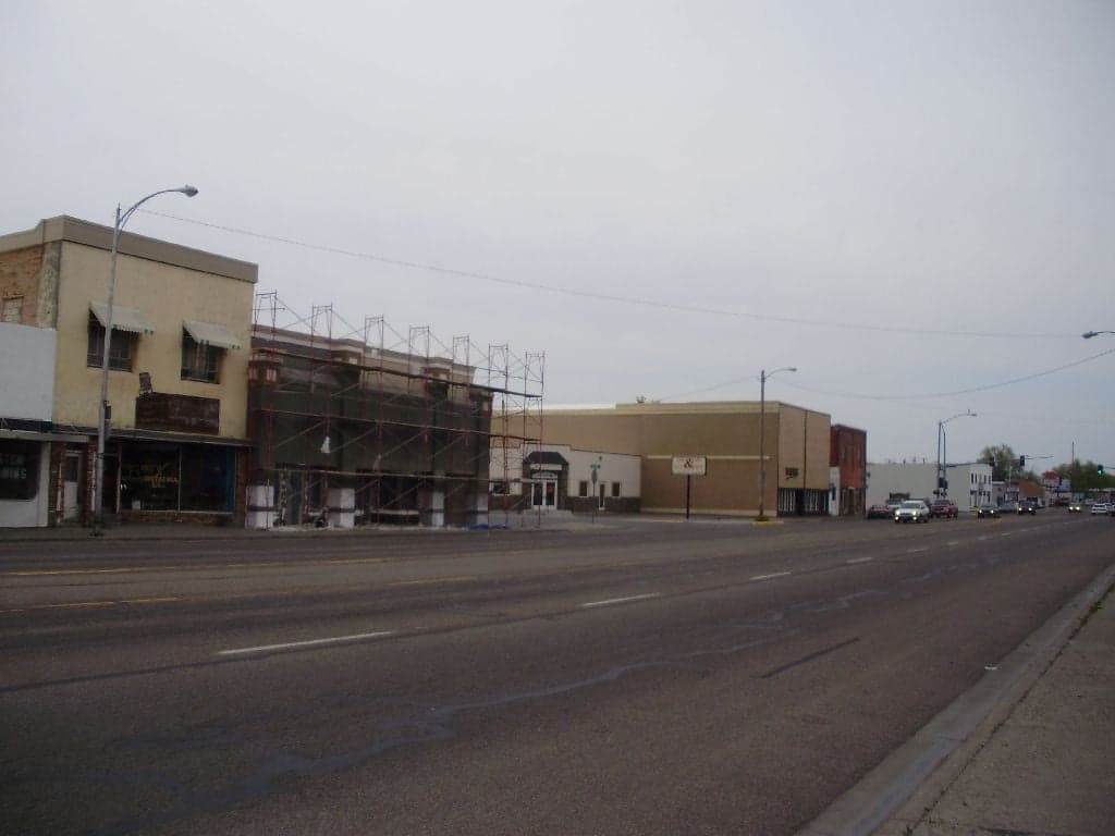
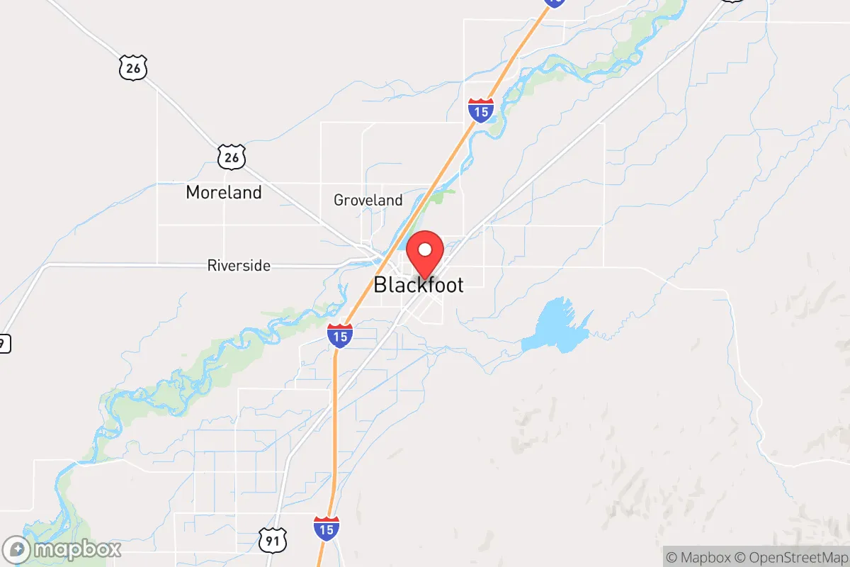
Blackfoot, Idaho, sits in a position that resilience-minded relocators should take seriously: far enough from major population centers to avoid the worst of cascading collapse, yet close enough to essential infrastructure to maintain a functional post-disruption life. Located in Bingham County along the Snake River, this town of roughly 12,000 people offers a blend of agricultural self-sufficiency, low population density, and geographic isolation that makes it a viable fallback location for those concerned about civil unrest, supply chain failures, or large-scale disasters. Its strategic value lies not in flashy amenities but in hard, boring fundamentals: water, food production, distance from likely targets, and a community that still operates on a first-name basis.
Geographic position and natural advantages for long-term stability
Blackfoot’s location in southeastern Idaho places it in a corridor that is both defensible and productive. The Snake River runs directly through the area, providing a reliable surface water source that is less contested than groundwater in drier western states. The surrounding landscape is a mix of irrigated farmland and high desert, which means the region has both the soil and the water to support local food production—critical if national distribution networks falter. The city sits at roughly 4,500 feet elevation, which moderates summer heat and reduces wildfire risk compared to lower-elevation intermountain areas. Winters are cold but manageable, with average snowfall around 20 inches, and the dry climate means less mold, rot, and structural degradation over time. For a prepper, the absence of hurricane, tornado, and earthquake threats is a significant plus. The nearest major population center is Idaho Falls, about 25 miles north, which is small enough (roughly 65,000 people) that it wouldn't generate the same refugee flows as a Denver or Salt Lake City in a crisis. Boise is 250 miles west; Salt Lake City is 180 miles south. That buffer matters.
Risks, exposures, and proximity to fallout-relevant landmarks
No location is risk-free, and Blackfoot has specific vulnerabilities that a strategic relocator must weigh. The most obvious is the Idaho National Laboratory (INL), located roughly 30 miles west of town. INL is a major nuclear research and testing facility, and while it has a strong safety record, it is a potential target for both state actors and domestic terrorists in a worst-case scenario. A deliberate attack or catastrophic accident at INL could produce a radioactive plume that, depending on wind patterns, could affect Blackfoot. That said, the prevailing winds in the region blow from the southwest, which would carry contamination away from the town in most scenarios. Still, anyone serious about fallout should have a plan for monitoring wind direction and sheltering in place. Another exposure is the Union Pacific rail line that runs through town, carrying freight that could include hazardous materials. On the plus side, Blackfoot is not near any major military bases, chemical plants, or large-scale refineries that would be high-priority targets. The nearest interstate is I-15, about 20 miles west, which provides a route for evacuation or supply movement but also a potential vector for unrest-driven migration from larger cities. The town’s small size and limited through-traffic mean that a determined group could effectively control access points if needed, but that same isolation could become a liability if medical evacuation or resupply becomes urgent.
Practical resilience for a relocator: food, water, energy, and defensibility
For a prepper or survivalist, the day-to-day viability of a location matters more than abstract strategic position. Blackfoot scores well on the basics. The Snake River provides abundant water, but note that water rights in Idaho are prior-appropriation—meaning senior rights holders get first claim. A relocator buying property should verify water rights or plan on drilling a well. The agricultural base means local food production is a reality, not a fantasy: potatoes, wheat, barley, and sugar beets are grown in the region, and there are active farmers' markets and local meat producers. The area also has a strong hunting and fishing culture, with access to public lands in the Caribou-Targhee National Forest and the Blackfoot River for trout. Energy is a mixed picture. The grid is served by Idaho Power, which relies heavily on hydroelectric generation from the Snake River system—a relatively stable source compared to coal or natural gas, but vulnerable to drought. Solar potential is good, with over 200 sunny days per year, and many rural properties already have backup generators or propane tanks. Defensibility is where Blackfoot shines. The town is laid out on a grid with open farmland on most sides, meaning approaches are visible. The population is homogeneous and largely conservative, which reduces the likelihood of internal factionalism during a crisis. The local sheriff’s office and small police force are likely to be overwhelmed in a major event, but the community has a strong tradition of mutual aid and church-based networks that can fill the gap. For a relocator, the key is to buy property outside the city limits—preferably with a well, septic, and enough acreage to grow food—while maintaining a presence in town for supplies and information.
The overall strategic picture for Blackfoot is one of moderate risk and high reward for the prepared relocator. It is not a fortress, and it is not immune to the cascading failures that could follow a national crisis. But it offers a rare combination of water, food, isolation, and a like-minded community that makes it a serious contender for anyone looking to ride out the storm. The proximity to INL is the single biggest wildcard, and anyone settling here should have a radiation detection kit and a shelter plan. Beyond that, Blackfoot is the kind of place where a well-stocked pantry, a reliable vehicle, and a few good neighbors can make the difference between surviving and thriving. If you are looking for a location that balances access to resources with distance from danger, this corner of Idaho deserves a hard look.
* Values derived from national, state, county, city and local statistics and may differ in a specific area. Last updated: 2026-04-19T09:33:10.000Z
Narrative content on this page is AI-generated and may contain mistakes. Verify any details that matter before acting on them.
ReloMaps may earn a commission from affiliate links at no extra cost to you.