
Photo: Wikipedia
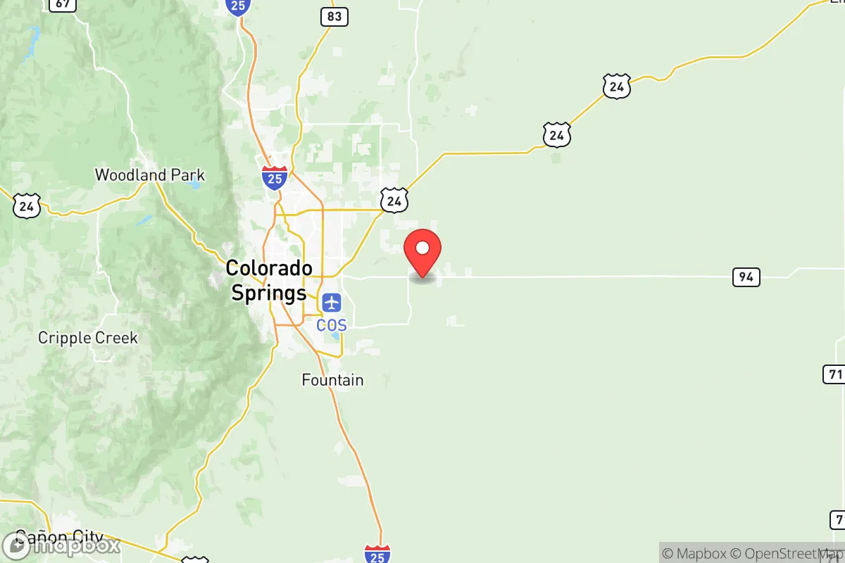
Strategic Assessment of El Paso County
Meaningful friction. Expect exposure to either population pressure, blast zones, or natural disaster risk. Consider buying a retreat property.
What does the Strategic Assessment tell us?
Our Strategic Assessment grades tactical survivability of an area. Major population centers, military targets, fallout zones, natural disasters, and border exposure all drive risk — lower exposure means a more defensible position in a crisis.
This is heavily inspired by Joel Skousen's Strategic Relocation book. Highly recommended you checkout the book ($)What does this tell us?
Our Strategic Assessment grades tactical survivability of an area. Major population centers, military targets, fallout zones, natural disasters, and border exposure all drive risk — lower exposure means a more defensible position in a crisis.
This is heavily inspired by Joel Skousen's Strategic Relocation book. Highly recommended you checkout the book ($)Strategic Pillars

Key Distances
Strategic Assessment Analysis
El Paso County, Colorado, offers a compelling mix of geographic isolation and strategic depth that appeals to those prioritizing long-term resilience and self-sufficiency. Anchored by Colorado Springs, the county sits at the eastern edge of the Rocky Mountains, providing a natural buffer against the chaos that could engulf larger metropolitan corridors like Denver or the I-25 front range. For a conservative-leaning relocator concerned with civic unrest, supply chain disruptions, or mass casualty events, this area presents a rare balance: close enough to critical infrastructure and medical hubs, yet far enough from the densest population centers and their associated vulnerabilities. The county’s elevation, dry climate, and military presence create a foundation for sustained independence, but the strategic picture demands a clear-eyed look at both its natural advantages and its exposure to fallout-relevant risks.
Geographic position and natural advantages for long-term security
El Paso County’s geography is its strongest asset. Sitting at roughly 6,000 feet above sea level, the region benefits from a semi-arid climate that reduces the risk of flooding, mold, and many vector-borne diseases common in lower elevations. The Front Range acts as a natural barrier to the west, while the high plains stretch eastward, offering wide, defensible sightlines and limited choke points for large-scale movement. Colorado Springs itself is positioned roughly 70 miles south of Denver, far enough to avoid the immediate fallout of a major urban collapse but close enough to access the Denver International Airport and major interstate corridors (I-25 and I-70) if needed. The county includes the towns of Fountain, Monument, and Peyton, each offering varying degrees of rural buffer. The nearby Fort Carson Army Base is a double-edged sword: it provides a massive military presence that could stabilize the area during unrest, but it also makes the region a potential target for adversaries. The United States Air Force Academy and Peterson Space Force Base further cement the area’s strategic importance, meaning any large-scale conflict would likely see this region as a priority for defense rather than abandonment. The natural water supply from the Arkansas River basin and the Rampart Range watershed offers a renewable source, though it requires careful management in drought years.
Risks, exposures, and proximity to fallout-relevant landmarks
No strategic assessment is complete without acknowledging the risks. El Paso County’s military infrastructure—Fort Carson, the Air Force Academy, Peterson SFB, and Schriever Space Force Base—makes it a high-value target in any conventional or asymmetric conflict. A mass casualty event or EMP strike aimed at these installations could cripple the region’s power grid and communications for weeks. Additionally, the county sits within 100 miles of the Rocky Flats National Wildlife Refuge (a former nuclear weapons plant) and the Platte River corridor, which could carry contamination from upstream incidents. The Pueblo Chemical Depot, about 40 miles south, stores chemical weapons awaiting destruction—a potential hazard if infrastructure fails during unrest. On the civilian side, the I-25 corridor is a major north-south artery that could become a funnel for refugees fleeing Denver or Pueblo during a crisis. Colorado Springs’ population of roughly 480,000 means the county is not a remote hideout; it’s a mid-sized city with suburban sprawl. The Cheyenne Mountain Complex, a hardened NORAD facility, is a positive for command-and-control continuity but also a potential lightning rod for adversaries. Wildfire risk is real—the 2012 Waldo Canyon Fire and 2013 Black Forest Fire destroyed hundreds of homes—and the dry climate means firefighting resources could be stretched thin during a broader emergency. Finally, the county’s reliance on the Colorado Springs Utilities grid, which includes a mix of coal, natural gas, and renewables, means a prolonged power outage would require backup generation or off-grid solar.
Practical resilience for a relocator: food, water, energy, and defensibility
For a relocator focused on practical self-sufficiency, El Paso County offers a workable but not effortless environment. Water is the primary concern: the region averages only 16 inches of precipitation annually, so rainwater catchment and well drilling are essential for any long-term homestead. The Arkansas River and Fountain Creek provide surface water, but access is regulated and requires permits. Food production is viable but limited by the short growing season (roughly 120 frost-free days) and alkaline soils; cold-hardy crops like potatoes, root vegetables, and certain grains perform well, but a full-scale garden requires hoop houses or greenhouses. The county’s abundant sunshine (over 300 days per year) makes solar power a reliable choice for off-grid energy, though winter snow can temporarily reduce output. Defensibility varies by location: properties in the Black Forest area or along the Rampart Range offer wooded cover and elevation, while those on the eastern plains near Peyton provide open fields of fire but less concealment. The Pikes Peak region to the west offers remote cabins and rugged terrain, but access can be cut off by snow or mudslides. Community resilience is mixed: the strong military and veteran presence means a higher-than-average number of trained individuals, but the county also has a growing population of newcomers from blue states, which can create cultural friction. Gun ownership is common, and Colorado is a shall-issue state for concealed carry, which aligns with a self-defense mindset. Medical infrastructure is solid: UCHealth Memorial Hospital and Penrose-St. Francis Health Services provide trauma care, but rural areas may be 30-45 minutes from emergency services. Food storage is straightforward due to the dry climate—mold and pests are less of a threat than in humid regions—and local farmers’ markets and co-ops offer some supply chain redundancy.
The overall strategic picture for El Paso County is one of qualified optimism for the prepared relocator. It is not a bug-out location in the remote wilderness sense, but a defensible, resource-rich region with a strong military backbone and a culture that values independence. The risks—military targeting, wildfire, water scarcity, and proximity to a major city—are real but manageable with proper planning. For a conservative-leaning individual or family willing to invest in off-grid infrastructure, build community with like-minded neighbors, and stay aware of the regional threat landscape, El Paso County offers a solid foundation for weathering the storms ahead. The key is to avoid the denser suburbs of Colorado Springs itself and focus on the rural fringes—Fountain to the south, Peyton to the east, or the mountain foothills to the west—where space, defensibility, and resource control are within reach.
* Values derived from national, state, county, city and local statistics and may differ in a specific area. Last updated: 2026-05-12T01:29:57.000Z
Narrative content on this page is AI-generated and may contain mistakes. Verify any details that matter before acting on them.
ReloMaps may earn a commission from affiliate links at no extra cost to you.