Photo: Wikipedia
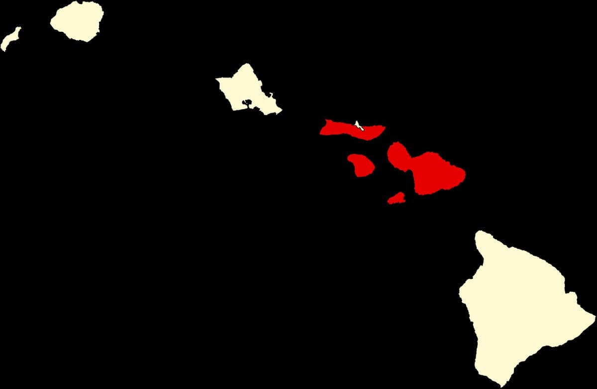
Strategic Assessment of Maui County
Workable tactical position. Some exposure to population density or targets, but generally defensible in a crisis.
What does the Strategic Assessment tell us?
Our Strategic Assessment grades tactical survivability of an area. Major population centers, military targets, fallout zones, natural disasters, and border exposure all drive risk — lower exposure means a more defensible position in a crisis.
This is heavily inspired by Joel Skousen's Strategic Relocation book. Highly recommended you checkout the book ($)What does this tell us?
Our Strategic Assessment grades tactical survivability of an area. Major population centers, military targets, fallout zones, natural disasters, and border exposure all drive risk — lower exposure means a more defensible position in a crisis.
This is heavily inspired by Joel Skousen's Strategic Relocation book. Highly recommended you checkout the book ($)Strategic Pillars

Key Distances
Strategic Assessment Analysis
Maui County presents a complex strategic picture for the conservative prepper: it offers genuine geographic isolation and a tight-knit, rural culture that values self-reliance, but it also carries severe logistical vulnerabilities that could turn the island into a trap during a national crisis. The county’s resilience is defined by its distance from mainland chaos—over 2,400 miles from the West Coast—and its limited, chokepoint-dependent infrastructure. For a relocator seeking to weather civic unrest, mass casualty events, or supply-chain collapse, Maui’s advantages in natural barriers and community cohesion must be weighed against its exposure to single-point failures in energy, food, and transportation.
Geographic isolation and natural defensive advantages of Maui County
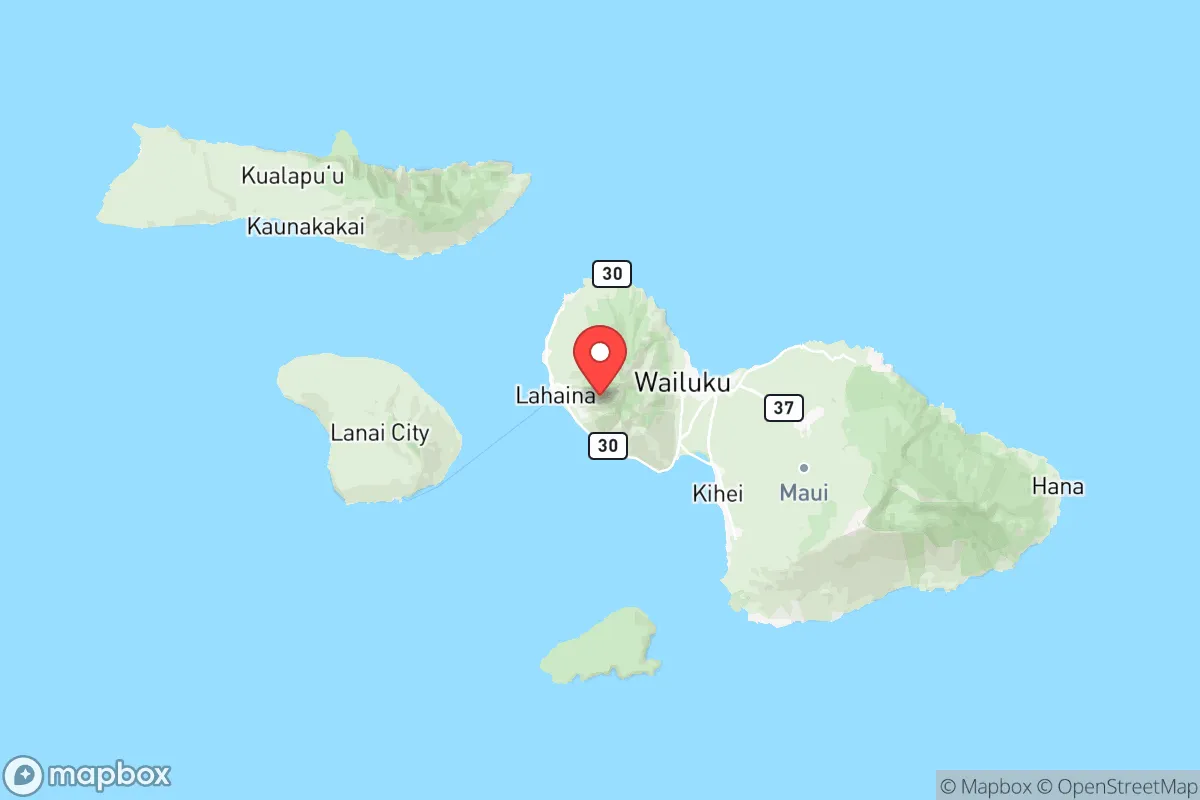
Maui County’s primary strategic asset is its position in the central Pacific, far from the dense population centers and industrial targets that define mainland risk. The county includes the islands of Maui, Molokai, Lanai, and Kaho‘olawe, with the main population hub in Kahului and the resort corridor of Kihei and Wailea. The island of Maui itself is roughly 48 miles long and 26 miles wide, offering a compact but defensible terrain. The West Maui Mountains and Haleakalā National Park create natural barriers that funnel movement through a few key corridors—primarily the Hana Highway (Route 360) and the Pi‘ilani Highway (Route 31). This chokepoint geography means a small, determined group could effectively control access to the remote eastern and northern valleys, such as Hana or Kipahulu, which have limited road access and are surrounded by rugged coastline. The county’s isolation also means that any large-scale unrest on the mainland would take days to reach Maui by sea or air, giving residents time to assess and react. For a prepper, this buffer is invaluable—Maui is not a primary target for nuclear strikes or civil war flashpoints, unlike Oahu with Pearl Harbor or the California coast.
Risks, exposures, and proximity to fallout-relevant landmarks
Despite its isolation, Maui County is not immune to fallout-relevant dangers. The most immediate risk is the Kahului Harbor, the county’s only deep-draft commercial port, which handles over 90% of all incoming goods—including fuel, food, and construction materials. A disruption at this single point—whether from a hurricane, terrorist attack, or civil unrest on the mainland—would cripple the island within weeks. The harbor is adjacent to the Kahului Airport (OGG), a major civilian and military airfield that also serves as a staging point for federal emergency response. In a national crisis, both the harbor and airport would become high-value targets for looters, government confiscation, or military seizure. Additionally, the Maui Electric Company’s Maalaea Power Plant and the Kahului Power Plant are critical infrastructure points; both rely on imported diesel and are vulnerable to fuel supply interruptions. While Maui has no nuclear power plants, the county is downwind of potential fallout from a strike on Oahu’s Pearl Harbor–Hickam Joint Base or the Red Hill Bulk Fuel Storage Facility—both about 100 miles northwest. A major event at those sites could contaminate prevailing trade winds and rain, affecting Maui’s water catchment systems. For the conservative prepper, the key takeaway is that Maui’s safety is contingent on the mainland’s stability; if the U.S. government collapses or ports shut down, the island becomes a prison.
Practical resilience for a relocator: food, water, energy, and defensibility
For a relocator serious about self-sufficiency, Maui County offers both promise and peril. Water is the most critical factor: the island’s windward slopes (e.g., Hana, Kula, and the slopes of Haleakalā) receive 100–300 inches of rain annually, making rainwater catchment a viable primary source. However, many leeward areas like Kihei and Wailea are arid and rely on municipal water pumped from the Iao Aquifer or the Wailuku River—both vulnerable to contamination or infrastructure failure. A prepper should target properties with private catchment tanks and a backup well, especially in the upcountry regions around Makawao or Kula, where elevation provides cooler temperatures and better defensibility. Food is a mixed bag: Maui has a strong agricultural tradition—cattle ranches like Ulupalakua Ranch and diversified farms in Kula produce beef, vegetables, and fruit—but the island imports roughly 85% of its food. A collapse in shipping would force rapid reliance on local growers, and land for large-scale farming is limited. Energy is the weakest link: Maui’s grid is 100% dependent on imported petroleum for electricity generation, with solar and wind providing only about 20% of capacity. A prepper should invest in off-grid solar with battery storage and a backup generator, plus a fuel cache (stored properly and rotated). Defensibility is high in the remote valleys—Hana, Kipahulu, and the Kaupo Gap area offer rugged terrain with few entry points—but these areas also lack medical facilities, with the nearest hospital being Maui Memorial Medical Center in Wailuku. For a family, the trade-off is clear: isolation buys security but demands extreme self-reliance in healthcare, education, and logistics.
Overall, Maui County is a high-risk, high-reward relocation option for the conservative prepper. Its geographic isolation and rural culture align well with a survivalist mindset, but the county’s dependence on a single port, imported energy, and mainland supply chains creates a brittle system that could fail catastrophically. The smart play is to treat Maui as a secondary retreat—a place to bug out to only if the mainland becomes uninhabitable—rather than a primary residence, unless you have the resources to build a fully off-grid homestead with years of stored supplies. For those willing to accept the logistical burden, the county’s natural barriers and tight-knit communities offer a rare sanctuary from the chaos of the mainland. But do not underestimate the cost: land in remote areas like Hana is expensive and hard to access, and the county’s political leanings (historically Democratic, with a strong local government) may clash with a prepper’s desire for minimal oversight. In short, Maui can work—but only for the prepared, the wealthy, and the patient.
* Values derived from national, state, county, city and local statistics and may differ in a specific area. Last updated: 2026-05-11T21:54:46.000Z
Narrative content on this page is AI-generated and may contain mistakes. Verify any details that matter before acting on them.
ReloMaps may earn a commission from affiliate links at no extra cost to you.