Photo: Wikipedia
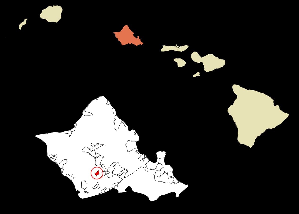
Strategic Assessment of Royal Kunia, HI
Meaningful friction. Expect exposure to either population pressure, blast zones, or natural disaster risk. Consider buying a retreat property.
What does the Strategic Assessment tell us?
Our Strategic Assessment grades tactical survivability of an area. Major population centers, military targets, fallout zones, natural disasters, and border exposure all drive risk — lower exposure means a more defensible position in a crisis.
This is heavily inspired by Joel Skousen's Strategic Relocation book. Highly recommended you checkout the book ($)What does this tell us?
Our Strategic Assessment grades tactical survivability of an area. Major population centers, military targets, fallout zones, natural disasters, and border exposure all drive risk — lower exposure means a more defensible position in a crisis.
This is heavily inspired by Joel Skousen's Strategic Relocation book. Highly recommended you checkout the book ($)Strategic Pillars

Key Distances
Regional Safe Places
Below is our recommended "safe zones" in Hawaii and the surrounding area based on our strategic heuristics. For most people, it's unrealistic to live in a “safe zone” full-time due to work, family or other personal reasons. They tend to be more rural. However, many of these areas are perfect for second homes and retreat properties that double as a vacation home or even a short-term rental.


Important Note: For informational purposes only. This does not mean nothing bad ever happens in the green zones. Please use common sense. This is based on public data and modeled with AI. We tried to take a conservative approach but mistakes happen. We update this regularly as new information becomes available.
Solar Generator Recommendations
Backup power matters more here than in safer locations. We've picked three solar generators across budgets and capacity tiers — start with the budget unit if you only need a few essentials, or step up if you want to run a fridge and HVAC for days at a time.

Jackery Portable Power Station Explorer 300
Budget OptionPower on the Go: Weighing only 11 lbs, it's convenient to set up and store with book-sized foldable solar panels

BLUETTI Portable Power Station AC180
Designed for both indoor and outdoor scenarios, AC180 is highly capable as it has a robost capacity and continuous output power.

EF ECOFLOW DELTA Pro Ultra Power Station
Upgraded PickEcoFlow DELTA Pro Ultra is a whole-home energy system designed to grow with your family. Integrated with the Smart Home Panel 2, it scales to meet your evolving energy needs — keeping your home powered, intelligent, and secure through every stage of life.
We earn a commission, at no additional cost to you.
Strategic Assessment Analysis
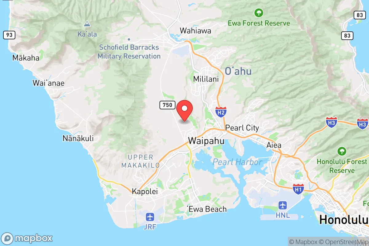
Royal Kunia, Hawaii, presents a complex strategic picture for the conservative prepper. Its primary advantage is geographic isolation—the island of Oahu is a fortress in the Pacific, but that same isolation becomes a double-edged sword when considering supply chain fragility and proximity to high-value military targets. The area itself sits on a plateau above Waipahu, offering natural elevation and a degree of separation from the dense urban corridors of Honolulu and Pearl Harbor, yet it remains within the blast radius of any major event targeting those areas. For the relocator prioritizing resilience, Royal Kunia offers a defensible terrain advantage but demands a hard-eyed assessment of its exposure to the very real fallout risks inherent to living on an island hosting the Pacific Command’s nerve center.
Geographic position and natural advantages for long-term survival
Royal Kunia’s location on the central plateau of Oahu, at roughly 800 to 1,000 feet elevation, provides a meaningful tactical advantage over the coastal floodplains. This elevation offers cooler temperatures, better visibility of the surrounding terrain, and natural drainage that reduces the risk of storm surge or tsunami inundation—a critical factor given Oahu’s exposure to Pacific cyclones and seismic events. The area is ringed by the Waianae and Koolau mountain ranges, creating natural chokepoints that could be monitored or defended in a grid-down scenario. The prevailing trade winds also help disperse airborne contaminants, a modest but real benefit if a localized industrial or biological event occurs downslope. For the prepper, the ability to observe approach routes from higher ground and the reduced humidity for long-term food storage are tangible, everyday advantages that lower-tier coastal neighborhoods simply cannot match.
Risks, exposures, and proximity to fallout-relevant landmarks
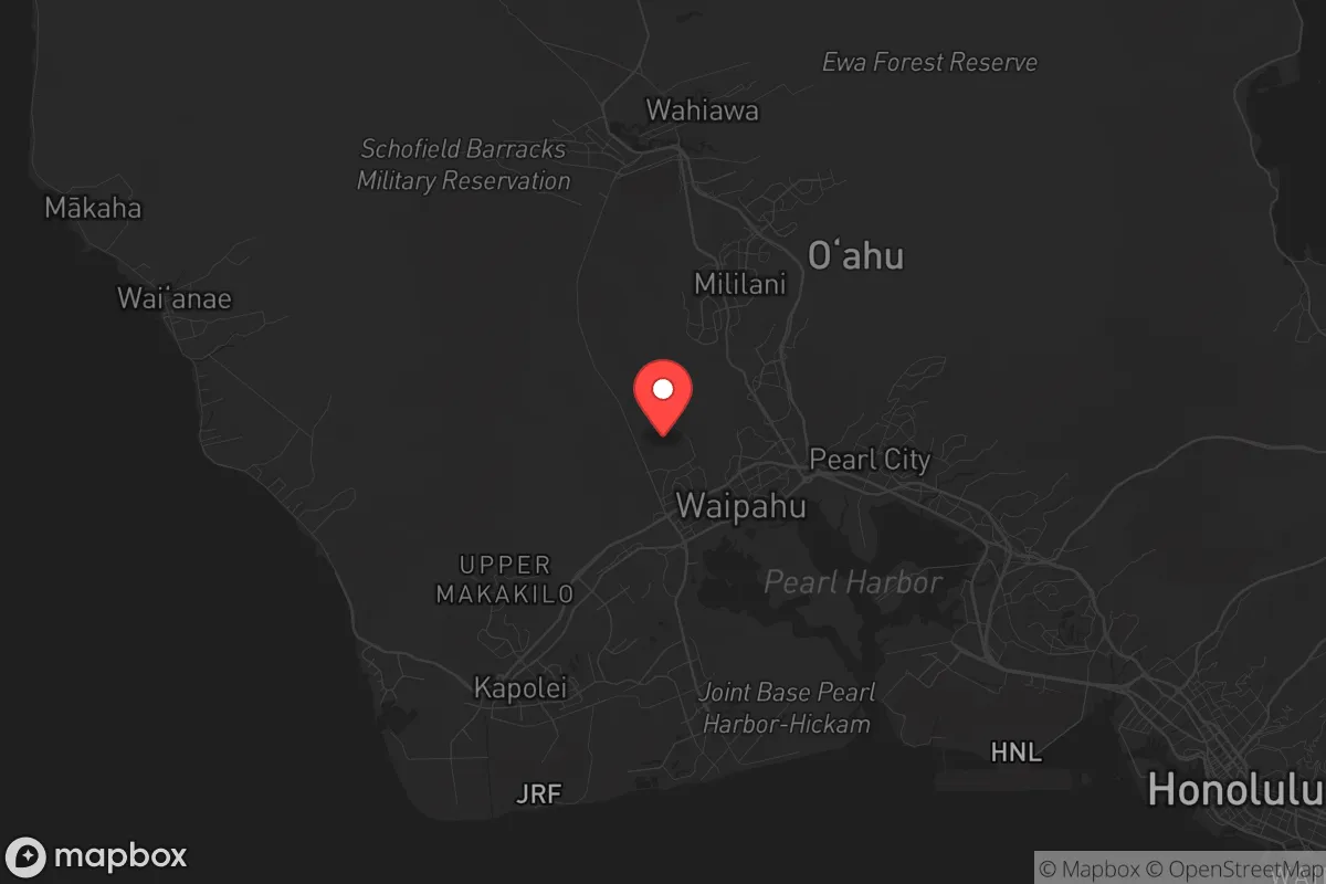
The sobering reality is that Royal Kunia sits roughly 10 miles northwest of Joint Base Pearl Harbor-Hickam, one of the most strategically critical military installations in the Pacific. In any major power conflict—particularly one involving China or North Korea—this base is a first-strike target. A nuclear or conventional strike on Pearl Harbor would generate catastrophic fallout patterns that, depending on wind direction, could directly impact Royal Kunia within hours. Additionally, the area is only 15 miles from Honolulu’s urban core, meaning any civil unrest, food riots, or mass evacuation events would funnel through the limited arterial roads (primarily H-1 and H-2) that connect the plateau to the rest of the island. The single road network is a critical vulnerability: a single accident or deliberate blockage at the Waipahu interchange could trap residents or prevent resupply. The proximity to the Kapolei energy corridor and the Barbers Point Naval Air Station (now Kalaeloa Airport) also means that any electromagnetic pulse (EMP) event targeting Oahu’s grid would likely degrade power and communications across the entire island, including Royal Kunia.
Practical resilience for a relocator: food, water, energy, and defensibility
For the relocator serious about self-sufficiency, Royal Kunia’s practical resilience is mixed. Water is the most pressing concern: the area relies on the Oahu aquifer system, which is vulnerable to saltwater intrusion, contamination from military fuel leaks (the Red Hill crisis is a recent, real-world example), or deliberate sabotage. A well is not a realistic option for most residential lots due to volcanic rock and permitting restrictions, so rainwater catchment and large-scale storage (5,000+ gallons) become essential. Food production is feasible but limited: the volcanic soil is fertile, and many lots have space for raised beds or greenhouse setups, but the year-round growing season is offset by the prevalence of invasive pests (coqui frogs, fruit flies) and the need for imported seeds and amendments. Local farmers markets exist but would collapse in a prolonged disruption. Energy independence is achievable: solar photovoltaic systems with battery storage are common and practical given the consistent sun, but any grid-tied system becomes useless without a transfer switch and a robust battery bank (Tesla Powerwall or equivalent). Defensibility is the strongest asset: the plateau’s limited access points—primarily Kunia Road and the H-2 off-ramps—can be monitored or physically blocked with vehicles or barriers. The neighborhood layout, with its cul-de-sacs and winding streets, naturally slows vehicular approach and creates a perimeter that a small, armed group could hold. However, the population density (roughly 4,000–5,000 residents in the immediate area) means that any long-term survival scenario would require cooperation with trusted neighbors, as solo prepping in a suburban setting is unsustainable.
The overall strategic picture for Royal Kunia is one of calculated trade-offs. It offers the best defensive terrain on Oahu outside of the remote North Shore or Windward side, with elevation, natural chokepoints, and a climate that supports year-round food production. But it is not a bug-out location—it is a suburban plateau within striking distance of the most targeted military infrastructure in the Pacific. For the conservative relocator who accepts that risk and invests heavily in water storage, off-grid power, and community-building, Royal Kunia can be a viable base of operations. For those seeking true isolation from fallout and civil unrest, the Big Island or Kauai would be more prudent choices. Royal Kunia is a compromise: a defensible perch on a vulnerable island, best suited for those who plan to hunker down rather than evacuate, and who have the resources to weather the first 90 days of any major disruption.
* Values derived from national, state, county, city and local statistics and may differ in a specific area. Last updated: 2026-04-24T11:00:40.000Z
Narrative content on this page is AI-generated and may contain mistakes. Verify any details that matter before acting on them.
ReloMaps may earn a commission from affiliate links at no extra cost to you.