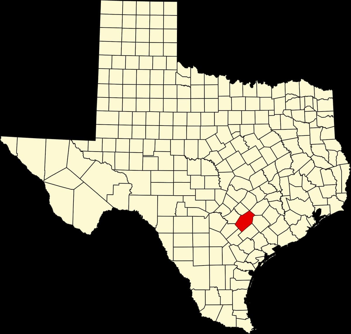
Photo: Wikipedia
Strategic Assessment of Gonzales County
Workable tactical position. Some exposure to population density or targets, but generally defensible in a crisis.
What does the Strategic Assessment tell us?
Our Strategic Assessment grades tactical survivability of an area. Major population centers, military targets, fallout zones, natural disasters, and border exposure all drive risk — lower exposure means a more defensible position in a crisis.
This is heavily inspired by Joel Skousen's Strategic Relocation book. Highly recommended you checkout the book ($)What does this tell us?
Our Strategic Assessment grades tactical survivability of an area. Major population centers, military targets, fallout zones, natural disasters, and border exposure all drive risk — lower exposure means a more defensible position in a crisis.
This is heavily inspired by Joel Skousen's Strategic Relocation book. Highly recommended you checkout the book ($)Strategic Pillars

Key Distances
Strategic Assessment Analysis
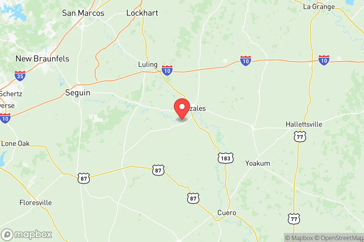
Gonzales County, Texas, offers a compelling mix of strategic depth and practical resilience for those prioritizing self-sufficiency and disaster preparedness. Located roughly midway between Austin and the Gulf Coast, the county leverages its position in the Texas Blackland Prairies and Post Oak Savannah ecoregions, providing reliable water access, fertile soils, and a low population density that naturally buffers against cascading urban failures. The county seat, Gonzales, sits about 70 miles east of San Antonio and 90 miles southeast of Austin, placing it far enough from major metropolitan centers to avoid their immediate fallout risks while remaining within a reasonable supply corridor.
Geographic position and natural advantages for long-term stability
Gonzales County’s geography is its primary strategic asset. The Guadalupe River runs through the county, providing a perennial water source that is less prone to the severe droughts affecting more western parts of Texas. The county sits atop the Carrizo-Wilcox Aquifer, one of the state’s largest and most reliable groundwater reserves, which supports both municipal wells and private domestic supplies. The terrain is gently rolling with mixed hardwood and pine forests, offering natural cover and defensible positions without the extreme fire risks of the Hill Country or the floodplain hazards of the coastal bend. The county’s agricultural base—primarily cattle, cotton, and corn—means that local food production is not just theoretical but operational, with working ranches and farms that could pivot to subsistence production if supply chains falter. The town of Waelder, in the northern part of the county, sits at the intersection of U.S. Highway 90 and U.S. Highway 183, providing multiple egress routes that avoid the chokepoints of Interstate 10 or Highway 183 closer to Austin. This redundancy in road networks is critical for evacuation or supply movement during a crisis.
Risks, exposures, and proximity to fallout-relevant landmarks
No strategic assessment is complete without acknowledging vulnerabilities. Gonzales County is not immune to natural hazards: it lies in Tornado Alley’s southern fringe, with an average of 3-5 tornado warnings per year, and the Guadalupe River has a history of flash flooding, particularly near the town of Gonzales and downstream communities like Cost. The county is also within 100 miles of the Houston Ship Channel and the Texas City refinery complex, which are high-value targets for both conventional and asymmetric attacks. A major incident at the ExxonMobil Baytown refinery or the Port of Houston could produce a toxic plume that, depending on wind patterns, might reach Gonzales County within 6-12 hours. Additionally, the county is roughly 120 miles from the South Texas Nuclear Generating Station near Bay City, a pressurized water reactor that, while well-regulated, represents a low-probability but high-consequence risk. The presence of the San Antonio military-industrial complex, including Fort Sam Houston and Lackland Air Force Base, adds another layer of strategic exposure—these are potential secondary targets that could disrupt regional logistics even if the county itself is not directly affected. The county’s rural character, however, means that most residents are not dependent on centralized infrastructure for survival; many properties have private wells, septic systems, and propane tanks, which reduces the cascading failure risk from a grid-down scenario.
Practical resilience for a relocator: food, water, energy, and defensibility
For a relocator serious about self-sufficiency, Gonzales County delivers on the basics. Water is the most critical resource, and the county’s combination of surface water (Guadalupe River, Peach Creek, and the San Marcos River along its western edge) and groundwater (Carrizo-Wilcox Aquifer) means that a properly sited property with a well can achieve water independence. The average well depth in the county is 200-400 feet, with yields of 10-30 gallons per minute—sufficient for household use and small-scale irrigation. Food resilience is supported by the county’s agricultural character: the Gonzales County Livestock Show and the local farmers’ market in Gonzales provide direct access to producers, and the county has a strong tradition of home gardening and canning. The Texas A&M AgriLife Extension office in Gonzales offers workshops on food preservation, soil management, and livestock husbandry, which are practical resources for newcomers. Energy resilience is more mixed: the county is served by the Electric Reliability Council of Texas (ERCOT) grid, which has demonstrated fragility during winter storms (e.g., Winter Storm Uri in 2021). However, the county’s low population density and abundance of open land make solar panel installation straightforward, and many rural properties already have backup generators. Defensibility is a function of the county’s layout: the town of Gonzales is compact and surrounded by farmland, offering clear sightlines and limited approach vectors. Smaller communities like Nixon, Smiley, and Leesville are even more dispersed, with properties often set back from main roads and shielded by tree lines. The county’s gun culture is robust—Gonzales is the site of the "Come and Take It" cannon, a symbol of armed self-reliance—and local law enforcement is responsive but not overbearing, with the Gonzales County Sheriff’s Office maintaining a visible presence without the surveillance density of urban jurisdictions.
The overall strategic picture for Gonzales County is one of moderate-to-high resilience with manageable trade-offs. It avoids the extreme risks of coastal exposure or urban proximity while retaining access to the resources and infrastructure of the Texas Triangle. The county’s agricultural base, reliable water sources, and low population density provide a solid foundation for long-term self-sufficiency, while its distance from high-value targets like the Houston Ship Channel and San Antonio military bases reduces the likelihood of direct fallout. The primary downsides are the ERCOT grid’s unreliability and the flood risk along the Guadalupe River, both of which can be mitigated through site selection and off-grid preparation. For a relocator who values practical independence over urban convenience, Gonzales County represents a defensible, resource-rich anchor point in the Texas landscape—one that balances isolation with accessibility, and tradition with the capacity to adapt.

* Values derived from national, state, county, city and local statistics and may differ in a specific area. Last updated: 2026-10-17T00:16:39.000Z
Narrative content on this page is AI-generated and may contain mistakes. Verify any details that matter before acting on them.
ReloMaps may earn a commission from affiliate links at no extra cost to you.

