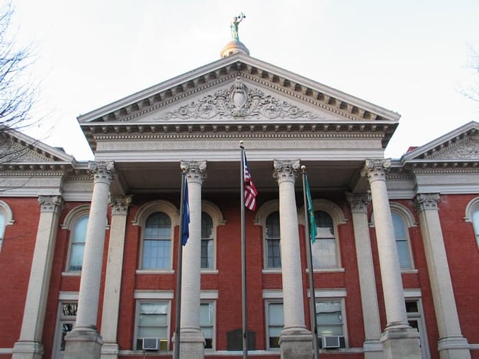
Photo: Wikipedia
Strategic Assessment of Augusta County
Meaningful friction. Expect exposure to either population pressure, blast zones, or natural disaster risk. Consider buying a retreat property.
What does the Strategic Assessment tell us?
Our Strategic Assessment grades tactical survivability of an area. Major population centers, military targets, fallout zones, natural disasters, and border exposure all drive risk — lower exposure means a more defensible position in a crisis.
This is heavily inspired by Joel Skousen's Strategic Relocation book. Highly recommended you checkout the book ($)What does this tell us?
Our Strategic Assessment grades tactical survivability of an area. Major population centers, military targets, fallout zones, natural disasters, and border exposure all drive risk — lower exposure means a more defensible position in a crisis.
This is heavily inspired by Joel Skousen's Strategic Relocation book. Highly recommended you checkout the book ($)Strategic Pillars

Key Distances
Strategic Assessment Analysis
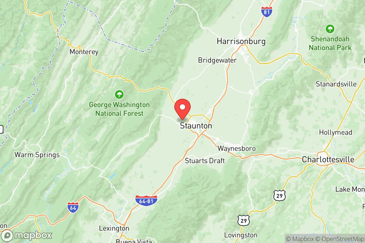
Augusta County, Virginia, occupies a strategic position in the Shenandoah Valley that offers a compelling mix of geographic isolation and practical self-sufficiency for those prioritizing disaster readiness. Its location west of the Blue Ridge Mountains and east of the Allegheny Front places it in a natural corridor that has historically been a refuge during crises, while its distance from major metropolitan targets like Washington D.C. (roughly 150 miles) and Richmond (about 100 miles) reduces exposure to primary fallout zones. For a relocator weighing resilience against access to resources, Augusta County presents a balanced profile—close enough to supply chains and medical hubs like Charlottesville and Harrisonburg, yet far enough from high-density population centers to offer genuine breathing room.
Geographic position and natural advantages for long-term stability
Augusta County’s geography is its strongest asset. The county sits in the Shenandoah Valley, a broad, fertile basin flanked by the Blue Ridge Mountains to the east and the Allegheny Mountains to the west. This topography provides natural defensibility: the mountains create physical barriers that slow movement and limit line-of-sight threats, while the valley floor offers some of the most productive agricultural land in Virginia. The county seat, Staunton, and the city of Waynesboro anchor the region, but the county itself is largely rural, with a population density of roughly 80 people per square mile—low enough to avoid the crowding that amplifies resource competition during disruptions. The Shenandoah National Park and George Washington National Forest border the county to the east and west, respectively, offering vast tracts of undeveloped land that could serve as buffer zones or emergency foraging areas. Water resources are abundant: the South River and Middle River flow through the county, and the Shenandoah River system provides a reliable surface water supply. The region’s karst topography also means numerous springs and groundwater sources, though well depth and yield vary by location. For a relocator, the combination of defensible terrain, fertile soil, and ample water makes Augusta County one of the stronger bets in the Mid-Atlantic for long-term stability.
Risks, exposures, and proximity to fallout-relevant landmarks
No location is risk-free, and Augusta County has specific vulnerabilities that a strategic relocator must weigh. The most significant man-made risk is proximity to Fort Barfoot (formerly Fort Pickett), located about 90 miles southeast near Blackstone. While not a primary nuclear target, Fort Barfoot is a training and mobilization center that could become a secondary target or a source of military traffic during a crisis. Closer to home, the county lies about 120 miles southwest of the Dulles International Airport and Washington D.C. metro area, which are high-priority targets in any major conflict. Prevailing winds from the west and southwest mean that fallout from a D.C.-area strike would likely drift eastward, away from Augusta County, but a strike on the Norfolk Naval Shipyard (roughly 150 miles southeast) could push particulate matter up the James River Valley under certain weather patterns. Natural risks are more immediate: the county sits in a moderate seismic zone—the 2011 Mineral earthquake (magnitude 5.8) was felt strongly here—and the Shenandoah Valley is prone to occasional flooding along the South River, particularly in low-lying areas near Waynesboro. Winter storms can be severe, with the mountains amplifying snowfall and ice accumulation, potentially isolating rural communities for days. The county’s reliance on a few major highways—Interstate 81 and U.S. Route 250—means that a single accident or bridge failure could disrupt supply lines. On balance, the man-made risks are lower than in Northern Virginia or the Richmond metro, but they are not zero, and the natural hazards require preparation for self-sufficiency during winter and flood events.
Practical resilience for a relocator: food, water, energy, and defensibility
For someone serious about self-sufficiency, Augusta County offers a strong foundation. Food production is a standout: the county is one of Virginia’s top agricultural producers, with over 1,200 farms covering more than 200,000 acres. Crops include corn, soybeans, hay, and apples—the region is famous for its apple orchards around Mount Solon and Fishersville. Livestock operations, particularly cattle and poultry, are widespread, meaning local meat and dairy are available even in normal times. Farmers’ markets operate year-round in Staunton and Waynesboro, and the county’s agricultural extension office provides resources for home gardening and livestock management. Water security is generally good, but not automatic. Municipal water systems serve Staunton, Waynesboro, and the larger communities, but rural properties rely on wells. Well yields in the valley are typically adequate (10-30 gallons per minute), but drought years can lower water tables, and the limestone bedrock can introduce hard water or mineral contamination. A backup hand pump or storage tank is advisable. Energy infrastructure is a mixed picture: the county is served by Dominion Energy and several electric cooperatives, but the mountainous terrain makes power lines vulnerable to ice and wind damage. Outages lasting several days are not uncommon after winter storms. Solar potential is moderate—the valley gets about 200 sunny days per year—but the surrounding mountains can cast shadows in winter. Wood heating is practical, given the proximity to national forests, but legal firewood collection requires permits. Defensibility is where Augusta County truly shines. The rural layout, with scattered farmsteads and small towns separated by open fields and wooded ridges, makes it difficult for any large group to move through unnoticed. The county’s many secondary roads and unpaved forest service roads offer multiple escape routes and resupply paths. The local culture, rooted in farming and hunting, means a significant portion of the population is familiar with firearms, basic veterinary care, and mechanical repair—skills that become invaluable in a grid-down scenario. The county’s emergency services are professional but stretched thin over a large area; response times in remote areas can exceed 30 minutes, so medical self-reliance is important.
The overall strategic picture for Augusta County is one of high potential with moderate, manageable risks. It is not a fallout-free zone—no place east of the Mississippi is—but its distance from primary targets, combined with its agricultural base, water resources, and defensible terrain, makes it one of the more resilient locations in Virginia. The presence of Staunton and Waynesboro as service hubs ensures access to hardware stores, medical clinics, and supply chains without the density of a major city. For a relocator who values self-sufficiency and is willing to invest in well maintenance, solar backup, and winter preparedness, Augusta County offers a realistic balance of isolation and accessibility. The key is to treat it as a base for long-term resilience, not a guaranteed safe zone—preparation, community ties, and local knowledge will determine outcomes more than geography alone.

* Values derived from national, state, county, city and local statistics and may differ in a specific area. Last updated: 2026-10-19T00:06:15.000Z
Narrative content on this page is AI-generated and may contain mistakes. Verify any details that matter before acting on them.
ReloMaps may earn a commission from affiliate links at no extra cost to you.

