Photo: Wikipedia
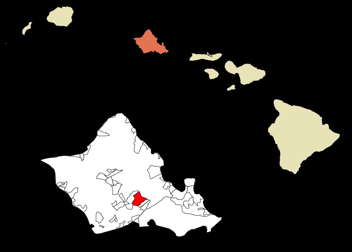
Strategic Assessment of Waimalu, HI
Meaningful friction. Expect exposure to either population pressure, blast zones, or natural disaster risk. Consider buying a retreat property.
What does the Strategic Assessment tell us?
Our Strategic Assessment grades tactical survivability of an area. Major population centers, military targets, fallout zones, natural disasters, and border exposure all drive risk — lower exposure means a more defensible position in a crisis.
This is heavily inspired by Joel Skousen's Strategic Relocation book. Highly recommended you checkout the book ($)What does this tell us?
Our Strategic Assessment grades tactical survivability of an area. Major population centers, military targets, fallout zones, natural disasters, and border exposure all drive risk — lower exposure means a more defensible position in a crisis.
This is heavily inspired by Joel Skousen's Strategic Relocation book. Highly recommended you checkout the book ($)Strategic Pillars

Key Distances
Regional Safe Places
Below is our recommended "safe zones" in Hawaii and the surrounding area based on our strategic heuristics. For most people, it's unrealistic to live in a “safe zone” full-time due to work, family or other personal reasons. They tend to be more rural. However, many of these areas are perfect for second homes and retreat properties that double as a vacation home or even a short-term rental.


Important Note: For informational purposes only. This does not mean nothing bad ever happens in the green zones. Please use common sense. This is based on public data and modeled with AI. We tried to take a conservative approach but mistakes happen. We update this regularly as new information becomes available.
Solar Generator Recommendations
Backup power matters more here than in safer locations. We've picked three solar generators across budgets and capacity tiers — start with the budget unit if you only need a few essentials, or step up if you want to run a fridge and HVAC for days at a time.

Jackery Portable Power Station Explorer 300
Budget OptionPower on the Go: Weighing only 11 lbs, it's convenient to set up and store with book-sized foldable solar panels

BLUETTI Portable Power Station AC180
Designed for both indoor and outdoor scenarios, AC180 is highly capable as it has a robost capacity and continuous output power.

EF ECOFLOW DELTA Pro Ultra Power Station
Upgraded PickEcoFlow DELTA Pro Ultra is a whole-home energy system designed to grow with your family. Integrated with the Smart Home Panel 2, it scales to meet your evolving energy needs — keeping your home powered, intelligent, and secure through every stage of life.
We earn a commission, at no additional cost to you.
Strategic Assessment Analysis
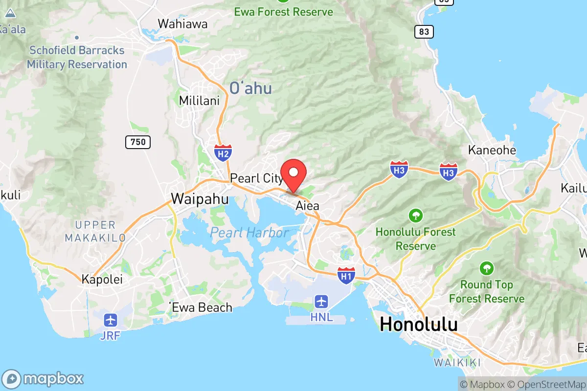
Waimalu, Hawaii, presents a complex strategic picture for the conservative prepper. Its primary advantage is its location on the island of Oahu, which provides a natural buffer from mainland unrest, but this same geography creates a trap if you are not prepared. The area sits in a narrow corridor between Pearl Harbor and the Ko'olau mountain range, offering limited egress routes and placing it squarely in the path of any event targeting Honolulu's military and infrastructure hubs. For the relocator seeking genuine resilience, Waimalu demands a sober assessment of its strengths as a staging ground versus its liabilities as a potential fallout zone.
Geographic position and natural advantages for long-term survival
Waimalu's position in central Oahu offers a mix of defensive and logistical considerations. The Ko'olau Range to the east provides a natural barrier against tsunami surges from the Pacific, while the Waianae Range to the west offers some shielding from prevailing weather patterns. The area's elevation, roughly 30 to 100 feet above sea level, places it above most storm surge risks, though it remains vulnerable to flash flooding from heavy rains channeled off the mountains. The proximity to Pearl Harbor and Hickam Air Force Base is a double-edged sword: these installations represent potential targets in a conflict, but they also anchor the island's supply chain and emergency response capabilities. For the prepper, the key advantage is the ability to access both windward and leeward sides of the island within 30 minutes, giving you options if one corridor becomes compromised. The year-round growing season is a genuine asset, allowing for continuous food production if you secure land and water rights—something increasingly rare on Oahu.
Risks, exposures, and proximity to fallout-relevant landmarks
The most significant risk for Waimalu is its location within the blast and fallout radius of critical military infrastructure. Pearl Harbor Naval Shipyard, Hickam Air Force Base, and Schofield Barracks are all within 10 to 15 miles, making this area a high-priority target in any peer-state conflict. The nearby Honolulu International Airport and the Kapolei energy hub add to the risk profile. In a civil unrest scenario, Waimalu's position along the H-1 freeway corridor means it would be a chokepoint for movement between Honolulu and the Leeward Coast, potentially drawing looters or displaced populations. The area also sits near the Waiawa Correctional Facility, which could become a liability during a breakdown in order. Natural hazards include volcanic vog from Kilauea, which can degrade air quality for weeks at a time, and the ever-present risk of a major hurricane—Oahu hasn't taken a direct hit since 1992, but the infrastructure is not hardened for a Category 4 or 5 event. The single road network (H-1, H-2, H-3) means any major incident can trap residents on the Leeward side or in the central valley.
Practical resilience for a relocator: food, water, energy, and defensibility
For the prepper evaluating Waimalu, the practical realities are sobering. The municipal water supply comes from the Waiahole Ditch system and the Pearl Harbor aquifer, both vulnerable to contamination or disruption. A private well is rare in this suburban area, so rainwater catchment and storage are essential—plan for at least 55 gallons per person for a 30-day supply. The electrical grid is island-wide and fragile, with rolling brownouts becoming more common as the state pushes renewable mandates without adequate baseload replacement. Solar with battery backup is a must, but HOA restrictions in many Waimalu neighborhoods can limit panel placement. Food resilience is the strongest asset: the surrounding agricultural lands in Waipahu and Kunia produce taro, bananas, and vegetables year-round, and the local farmers' markets are a viable supply line if you build relationships early. Defensibility is poor in the typical suburban layout—tight lots, shared walls, and limited sightlines. A better approach is to treat Waimalu as a logistics hub rather than a final redoubt, with a secondary property on the Big Island or Kauai for true retreat. The local gun culture is muted compared to the mainland, but the state's strict firearms laws mean you should bring what you need before relocating, as magazine capacity and carry permits are heavily restricted.
The overall strategic picture for Waimalu is one of calculated risk. It offers the benefits of island isolation, a stable climate, and access to agricultural resources, but it sits in the shadow of some of the most critical military infrastructure in the Pacific. For the conservative relocator, this is not a bugout location—it is a forward operating base. You can live comfortably here during stable times, leveraging the local economy and community, but you must have a plan for extraction or shelter-in-place when the balloon goes up. The real value of Waimalu is as a stepping stone: a place to build skills, store supplies, and network with like-minded individuals before moving to a more defensible position on a neighbor island or a remote part of the Big Island. If you are willing to accept the proximity to risk in exchange for the conveniences of modern life, Waimalu can work. But if you are looking for a place to ride out the collapse without constant vigilance, look further up the coast or off the grid entirely.
* Values derived from national, state, county, city and local statistics and may differ in a specific area. Last updated: 2026-04-24T07:23:12.000Z
Narrative content on this page is AI-generated and may contain mistakes. Verify any details that matter before acting on them.
ReloMaps may earn a commission from affiliate links at no extra cost to you.