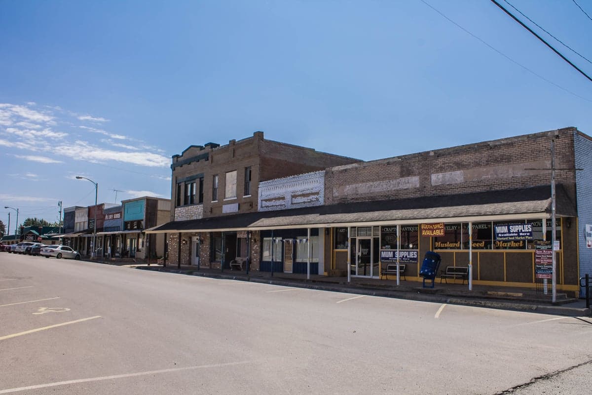
Photo: Courtney Rose via Unsplash
Strategic Assessment of Whitney, TX
Meaningful friction. Expect exposure to either population pressure, blast zones, or natural disaster risk. Consider buying a retreat property.
What does the Strategic Assessment tell us?
Our Strategic Assessment grades tactical survivability of an area. Major population centers, military targets, fallout zones, natural disasters, and border exposure all drive risk — lower exposure means a more defensible position in a crisis.
This is heavily inspired by Joel Skousen's Strategic Relocation book. Highly recommended you checkout the book ($)What does this tell us?
Our Strategic Assessment grades tactical survivability of an area. Major population centers, military targets, fallout zones, natural disasters, and border exposure all drive risk — lower exposure means a more defensible position in a crisis.
This is heavily inspired by Joel Skousen's Strategic Relocation book. Highly recommended you checkout the book ($)Strategic Pillars

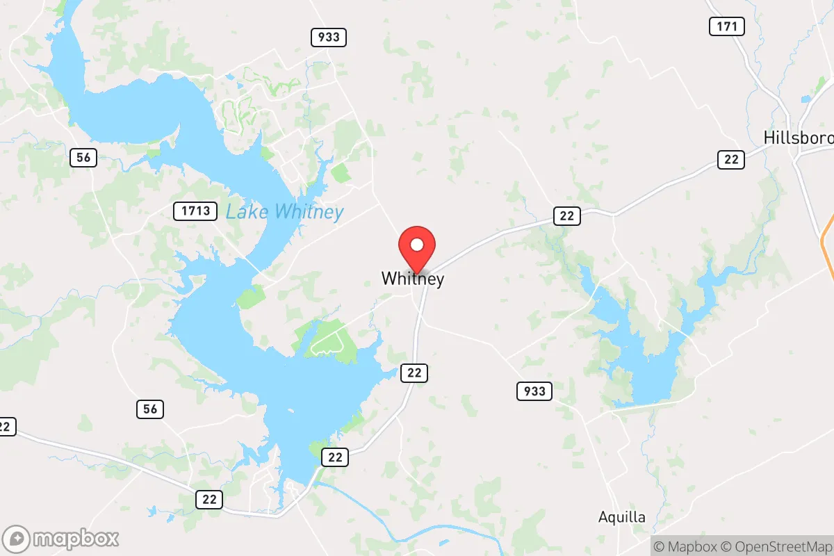
Key Distances
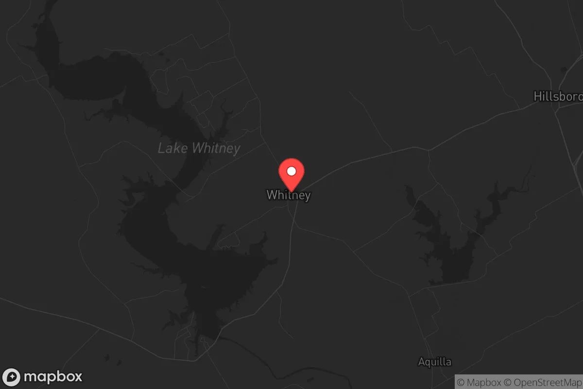
Regional Safe Places
Below is our recommended "safe zones" in Texas and the surrounding area based on our strategic heuristics. For most people, it's unrealistic to live in a “safe zone” full-time due to work, family or other personal reasons. They tend to be more rural. However, many of these areas are perfect for second homes and retreat properties that double as a vacation home or even a short-term rental.


Important Note: For informational purposes only. This does not mean nothing bad ever happens in the green zones. Please use common sense. This is based on public data and modeled with AI. We tried to take a conservative approach but mistakes happen. We update this regularly as new information becomes available.
Solar Generator Recommendations
Backup power matters more here than in safer locations. We've picked three solar generators across budgets and capacity tiers — start with the budget unit if you only need a few essentials, or step up if you want to run a fridge and HVAC for days at a time.

Jackery Portable Power Station Explorer 300
Budget OptionPower on the Go: Weighing only 11 lbs, it's convenient to set up and store with book-sized foldable solar panels

BLUETTI Portable Power Station AC180
Designed for both indoor and outdoor scenarios, AC180 is highly capable as it has a robost capacity and continuous output power.

EF ECOFLOW DELTA Pro Ultra Power Station
Upgraded PickEcoFlow DELTA Pro Ultra is a whole-home energy system designed to grow with your family. Integrated with the Smart Home Panel 2, it scales to meet your evolving energy needs — keeping your home powered, intelligent, and secure through every stage of life.
We earn a commission, at no additional cost to you.
Strategic Assessment Analysis
Whitney, Texas, sits in a strategic pocket of Hill Country that offers genuine resilience advantages for those thinking beyond the next election cycle. Its position roughly 50 miles southwest of Fort Worth and 70 miles south of Dallas-Fort Worth puts it outside the immediate blast radius of major metro targets, yet close enough to access supply chains and medical infrastructure when things are stable. The town’s population hovers around 2,500, with Lake Whitney providing a natural buffer and a reliable water source—two factors that matter when grid-down scenarios or civil unrest ripple outward from urban centers.
Geographic position and natural advantages for long-term security
Whitney’s location on the eastern edge of the Balcones Escarpment gives it a terrain advantage that flatland communities lack. The area is rolling limestone hills with scattered cedar and oak, offering multiple defensible positions and natural chokepoints along the Brazos River basin. Lake Whitney, a 23,500-acre reservoir created by the Whitney Dam, is the single most important asset for anyone serious about self-sufficiency. It’s a Corps of Engineers lake, meaning the water level is managed, but in a prolonged emergency, that surface water is gold. The dam itself is a potential vulnerability—if compromised, it could flood downstream communities—but for Whitney residents, the lake provides fishing, irrigation, and a year-round water supply that most of Texas’s drier counties lack. The surrounding Bosque and Hill County terrain also means fewer through-roads, which slows down any large-scale movement of people fleeing the DFW corridor during a crisis.
Risks, exposures, and proximity to fallout-relevant landmarks
The biggest strategic downside is Whitney’s proximity to Interstate 35W, which runs about 25 miles east. That corridor is a primary evacuation route for millions of people in the DFW metroplex. In a mass casualty event, nuclear incident, or major civil unrest, I-35W becomes a parking lot or a refugee highway. Whitney sits far enough off the interstate to avoid the worst of that flow, but it’s not immune. Secondary roads like FM 933 and FM 1714 can get clogged if locals and outsiders both try to use them. The other major concern is the proximity to the Comanche Peak Nuclear Power Plant, located roughly 30 miles northeast near Glen Rose. While the plant has a solid safety record, any nuclear incident—whether from accident or sabotage—would put Whitney within the potential plume zone depending on wind direction. The prevailing winds in this region are from the south-southeast, which means fallout from Comanche Peak would likely drift toward the Dallas area, not Whitney. But that’s a calculation, not a guarantee. Also worth noting: Whitney is about 90 miles from the Pantex nuclear weapons assembly plant near Amarillo, but that’s far enough to be irrelevant for immediate fallout concerns. The real risk is the human wave from DFW, not the blast itself.
Practical resilience for a relocator: food, water, energy, and defensibility
For someone serious about prepping, Whitney checks several boxes. The lake provides a reliable water source, but you’ll need a filtration system—surface water in Texas carries agricultural runoff and bacteria. Many homes in the area already have private wells, which is a major plus. The local soil is thin and rocky, so large-scale gardening is tough without raised beds or imported topsoil, but the growing season is long (March through November) and there are established farms in the county that sell direct to locals. The Hill County Electric Cooperative serves the area, and power outages are common during storms, so a solar setup with battery storage is a smart investment. Natural gas is available in town but not in rural pockets; propane tanks are standard for off-grid homes. Defensibility is decent: the terrain limits sightlines, and the lake creates a natural barrier on the western side. The town itself is small enough that a determined group could secure the main access points—FM 933 from the east and FM 1714 from the south—but that’s a conversation for a different briefing. The local law enforcement presence is minimal; the Hill County Sheriff’s Office has about 20 deputies for the entire county, so don’t expect rapid response in a crisis. The nearest hospital is in Hillsboro, 20 miles east, but it’s a small facility. For serious trauma, you’re looking at Waco or Fort Worth, both of which could be compromised in a major event.
The overall strategic picture for Whitney is cautiously optimistic for the prepared relocator. It’s not a hardened bunker location—no place in Texas truly is—but it offers a balance of water access, terrain advantage, and distance from primary targets that many other small towns lack. The key is to treat it as a base, not a fortress. Build relationships with neighbors, stockpile supplies for at least 90 days, and have a secondary retreat plan if the DFW evacuation wave becomes a reality. Whitney won’t save you from a direct nuclear strike or a coordinated attack on infrastructure, but for the person who wants to be out of the immediate danger zone while still living in a functioning community, it’s a solid bet. The conservative values of the area—self-reliance, low crime, and a general distrust of federal overreach—align well with the prepper mindset. Just don’t expect the government to show up if things go sideways. That’s the whole point of being here.
* Values derived from national, state, county, city and local statistics and may differ in a specific area. Last updated: 2026-05-09T00:08:08.000Z
Narrative content on this page is AI-generated and may contain mistakes. Verify any details that matter before acting on them.
ReloMaps may earn a commission from affiliate links at no extra cost to you.