
Photo: Wikipedia
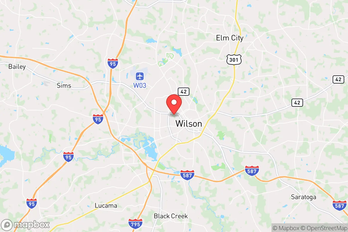
Strategic Assessment of Wilson, NC
Meaningful friction. Expect exposure to either population pressure, blast zones, or natural disaster risk. Consider buying a retreat property.
What does the Strategic Assessment tell us?
Our Strategic Assessment grades tactical survivability of an area. Major population centers, military targets, fallout zones, natural disasters, and border exposure all drive risk — lower exposure means a more defensible position in a crisis.
This is heavily inspired by Joel Skousen's Strategic Relocation book. Highly recommended you checkout the book ($)What does this tell us?
Our Strategic Assessment grades tactical survivability of an area. Major population centers, military targets, fallout zones, natural disasters, and border exposure all drive risk — lower exposure means a more defensible position in a crisis.
This is heavily inspired by Joel Skousen's Strategic Relocation book. Highly recommended you checkout the book ($)Strategic Pillars

Key Distances
Regional Safe Places
Below is our recommended "safe zones" in North Carolina and the surrounding area based on our strategic heuristics. For most people, it's unrealistic to live in a “safe zone” full-time due to work, family or other personal reasons. They tend to be more rural. However, many of these areas are perfect for second homes and retreat properties that double as a vacation home or even a short-term rental.


Important Note: For informational purposes only. This does not mean nothing bad ever happens in the green zones. Please use common sense. This is based on public data and modeled with AI. We tried to take a conservative approach but mistakes happen. We update this regularly as new information becomes available.
Solar Generator Recommendations
Backup power matters more here than in safer locations. We've picked three solar generators across budgets and capacity tiers — start with the budget unit if you only need a few essentials, or step up if you want to run a fridge and HVAC for days at a time.

Jackery Portable Power Station Explorer 300
Budget OptionPower on the Go: Weighing only 11 lbs, it's convenient to set up and store with book-sized foldable solar panels

BLUETTI Portable Power Station AC180
Designed for both indoor and outdoor scenarios, AC180 is highly capable as it has a robost capacity and continuous output power.

EF ECOFLOW DELTA Pro Ultra Power Station
Upgraded PickEcoFlow DELTA Pro Ultra is a whole-home energy system designed to grow with your family. Integrated with the Smart Home Panel 2, it scales to meet your evolving energy needs — keeping your home powered, intelligent, and secure through every stage of life.
We earn a commission, at no additional cost to you.
Strategic Assessment Analysis
Wilson, North Carolina, offers a surprisingly resilient strategic position for those prioritizing preparedness and self-sufficiency, balancing proximity to critical infrastructure with a buffer from the highest-risk urban zones. Located roughly 45 miles east of Raleigh and 50 miles west of Greenville, this city of about 49,000 sits in a sweet spot: close enough to access major medical and supply chains, yet far enough from the immediate blast radius and civil unrest patterns of a major metropolitan area. For the conservative prepper or survivalist, Wilson represents a viable "gray man" location—unremarkable, agriculturally rich, and positioned along key transportation corridors without being a primary target.
Geographic position and natural advantages for long-term survival
Wilson's geography is its strongest asset. The city lies in the coastal plain, a region characterized by flat, fertile land that historically supported tobacco and cotton, but today offers excellent potential for small-scale agriculture and livestock. The Tar River runs just north of the city, providing a reliable freshwater source, while the region's high water table means shallow wells are feasible for those with the means to drill. The climate is temperate, with mild winters and long growing seasons—ideal for year-round food production. Wilson is also situated at the intersection of Interstate 95 and U.S. Highway 264, giving residents rapid access to both the eastern seaboard and the interior. For a relocator, this means you can bug out to the mountains (about 3.5 hours west) or the coast (about 1.5 hours east) depending on the threat vector. The surrounding countryside is dotted with small farms, pine forests, and rural communities that offer natural cover and multiple egress routes. Unlike the Piedmont or mountain regions, the flat terrain here makes overland travel by foot or bike practical, and visibility is good for maintaining situational awareness.
Risks, exposures, and proximity to fallout-relevant landmarks
No location is without vulnerabilities, and Wilson has several that demand attention. The most immediate concern is proximity to Interstate 95, a major north-south corridor that in a crisis would become a chokepoint for refugees, military convoys, and looters. During a mass evacuation of the Northeast, Wilson could see significant transient traffic and potential civil unrest. Additionally, the city is within 50 miles of the Shearon Harris Nuclear Power Plant near Raleigh. While not in the immediate plume zone for a catastrophic failure, prevailing winds from the west could carry fallout toward Wilson in a worst-case scenario. The city also sits near CSX and Norfolk Southern rail lines that transport hazardous materials, including ammonia and chlorine, through the region. For the prepper, these are not deal-breakers but require planning: a good radiation detection kit, a well-stocked first aid kit for chemical exposure, and a pre-planned bug-out route east toward the coast or south toward Fayetteville. The city itself has a modest police force and a county sheriff's office, but in a prolonged grid-down scenario, law enforcement would be stretched thin. The presence of Wilson's own wastewater treatment plant and a regional medical center (Wilson Medical Center) are double-edged swords—they provide critical services but also make the city a potential target for those seeking resources during a collapse.
Practical resilience for a relocator: food, water, energy, and defensibility
For the individual or family looking to establish a resilient homestead, Wilson's practical assets are strong. Food production is the standout advantage. The surrounding agricultural land is some of the most productive in the state, with local farms growing soybeans, corn, sweet potatoes, and raising poultry and hogs. The Wilson Farmers Market operates year-round, and several u-pick operations exist within a 20-minute drive. For the prepper, this means you can establish relationships with local growers now, barter for bulk grains later, and even lease small plots for personal cultivation. Water is abundant but requires treatment. The Tar River and numerous creeks provide surface water, but you'll need a good filtration system (Berkey or Sawyer) and knowledge of boiling or chemical treatment. The city's municipal water comes from the Tar River and is treated, but in a prolonged power outage, pressure could fail. A backup well with a hand pump is a wise investment. Energy resilience is moderate. Wilson is in Duke Energy's service area, which has a mixed record on storm-related outages. Solar potential is decent—the region averages about 210 sunny days per year—and net metering is available. For off-grid capability, a modest solar array with battery storage (e.g., 5-10 kW) would cover basic refrigeration, lighting, and communications. Natural gas is available in town, but rural properties rely on propane or wood. Defensibility is where Wilson requires creativity. The city itself is not easily defensible due to its grid-like street layout and flat terrain. However, the surrounding rural areas—particularly north of the Tar River and east toward Elm City—offer properties with tree lines, long driveways, and natural barriers. A homestead with a clear field of fire, a well, and a root cellar is achievable within a 15-minute drive of downtown. The local gun culture is strong, with several gun shops and ranges in the county, and North Carolina's permitless carry law (effective 2023) means you can arm yourself without bureaucratic hurdles. The Wilson County Sheriff's Office is generally supportive of Second Amendment rights, and the community has a low tolerance for crime—a cultural asset in a crisis.
The overall strategic picture for Wilson is one of cautious optimism for the prepared relocator. It is not a hardened bunker location, nor is it a remote mountain redoubt. Instead, it offers a balanced mix of agricultural self-sufficiency, transportation access, and moderate risk exposure. The key is to treat Wilson as a base of operations, not a fortress. Establish a rural property with water and food production capability, maintain a low profile in town for supply runs and medical needs, and have a secondary bug-out location further east (e.g., the Croatan National Forest or the Outer Banks) for worst-case scenarios. The city's conservative lean—Wilson County voted +18 for Trump in 2020—means you'll find like-minded neighbors who value self-reliance and community defense. For the survivalist who wants to be near enough to civilization to thrive but far enough to survive, Wilson is a solid, under-the-radar choice. Just don't expect it to stay quiet if the lights go out along I-95.
* Values derived from national, state, county, city and local statistics and may differ in a specific area. Last updated: 2026-04-21T16:55:12.000Z
Narrative content on this page is AI-generated and may contain mistakes. Verify any details that matter before acting on them.
ReloMaps may earn a commission from affiliate links at no extra cost to you.