Photo: Wikipedia
Strategic Assessment of Miami Dade County
Meaningful friction. Expect exposure to either population pressure, blast zones, or natural disaster risk. Consider buying a retreat property.
What does the Strategic Assessment tell us?
Our Strategic Assessment grades tactical survivability of an area. Major population centers, military targets, fallout zones, natural disasters, and border exposure all drive risk — lower exposure means a more defensible position in a crisis.
This is heavily inspired by Joel Skousen's Strategic Relocation book. Highly recommended you checkout the book ($)What does this tell us?
Our Strategic Assessment grades tactical survivability of an area. Major population centers, military targets, fallout zones, natural disasters, and border exposure all drive risk — lower exposure means a more defensible position in a crisis.
This is heavily inspired by Joel Skousen's Strategic Relocation book. Highly recommended you checkout the book ($)Strategic Pillars

Key Distances
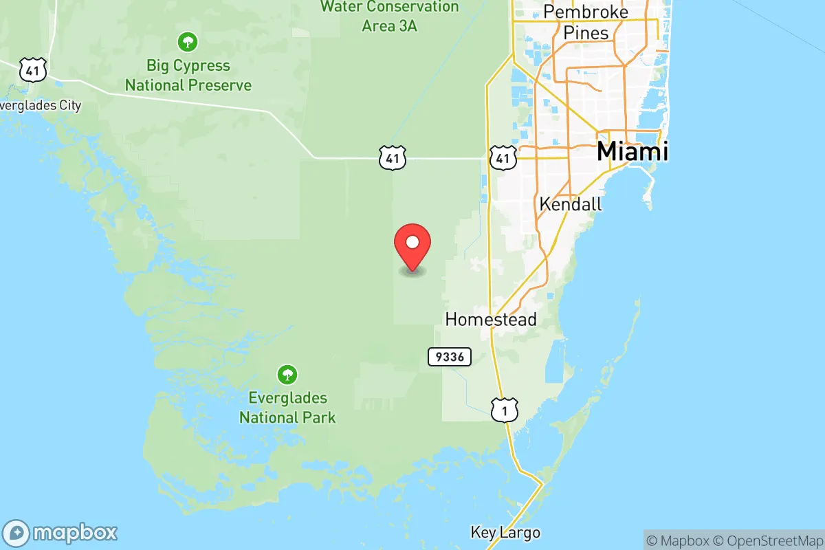
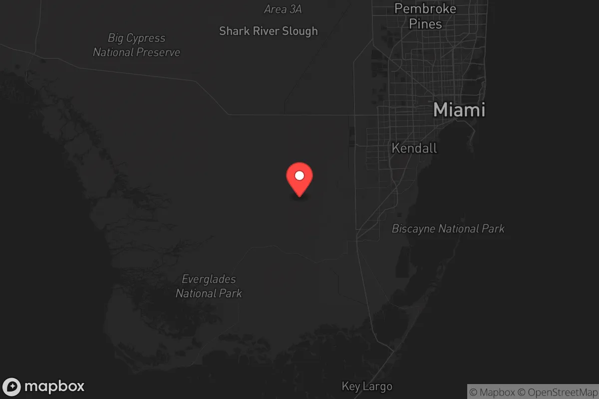
Strategic Assessment Analysis
Miami-Dade County presents a complex strategic picture for relocation-minded readers focused on resilience and self-sufficiency. While its geographic position offers unique advantages—proximity to international trade routes, a subtropical climate enabling year-round food production, and distance from major inland fallout targets—it also carries significant exposure to natural hazards and logistical vulnerabilities that demand careful consideration. The county’s 2.7 million residents are concentrated in a low-lying coastal strip, making it a study in contrasts between natural bounty and man-made risk.
Geographic position and natural advantages for long-term stability
Miami-Dade’s primary strategic asset is its location at the southeastern tip of the Florida peninsula, roughly 90 miles from the Bahamas and 150 miles from Cuba. This position places it far from the major industrial corridors of the eastern seaboard—over 1,000 miles from the New York-New Jersey port complex and 600 miles from the Savannah River nuclear site. The county’s subtropical climate, with average winter lows around 60°F and summer highs near 90°F, supports a 12-month growing season. The Biscayne Aquifer, a shallow freshwater lens underlying much of the county, provides a renewable water source, though it is vulnerable to saltwater intrusion and contamination. The Port of Miami, the busiest cruise port in the world and a major cargo hub, offers potential for supply chain access, but also represents a concentration of economic activity that could become a liability in a crisis. The Everglades National Park to the west and the Atlantic Ocean to the east create natural buffers, limiting overland approaches and providing defensible terrain for those who know it. Homestead, at the county’s southern edge, sits near the Biscayne National Park and offers a more rural alternative to the dense urban core, with agricultural land that could support local food production.
Natural and man-made risks: hurricanes, sea-level rise, and proximity to fallout-relevant landmarks
The most immediate threat to Miami-Dade is its vulnerability to hurricanes. The county has a 1-in-6 annual chance of a hurricane-force wind event, and storm surge from a Category 3 or higher storm could inundate up to 40% of the land area, including downtown Miami, Miami Beach, and Key Biscayne. Sea-level rise compounds this risk: the National Oceanic and Atmospheric Administration projects a 1-2 foot rise by 2050, which would increase tidal flooding frequency in low-lying neighborhoods like Shorecrest and Little Havana. Beyond natural hazards, the county’s man-made risk profile is moderate compared to major industrial targets. The nearest significant fallout-relevant landmarks are the Turkey Point Nuclear Generating Station, located about 25 miles south of downtown Miami in Homestead, and the PortMiami cargo facilities, which handle petroleum and chemicals. A major incident at Turkey Point—which has two operational reactors and two aging cooling canals—could render large portions of southern Miami-Dade uninhabitable for weeks. The county also hosts the Homestead Air Reserve Base, a military installation that could become a secondary target in a conflict scenario. The proximity to Cuba, just 90 miles away, introduces geopolitical uncertainty, though the island’s limited nuclear infrastructure reduces direct fallout risk. For a relocator, the key takeaway is that Miami-Dade’s risks are primarily natural rather than man-made, but the density of the population—over 1,000 people per square mile in urban areas—amplifies the consequences of any disaster.
Practical resilience for a relocator: food, water, energy, and defensibility
For a family or individual prioritizing self-sufficiency, Miami-Dade offers both opportunities and challenges. The county’s agricultural sector, concentrated in the Redland and Homestead areas, produces over $1 billion in crops annually, including tomatoes, avocados, and tropical fruits. The year-round growing season means that a determined homesteader can maintain a productive garden even in winter, a significant advantage over northern regions. However, the soil in much of the county is limestone-based and sandy, requiring amendment for intensive cultivation. Water access is a mixed picture: the Biscayne Aquifer is shallow and easily tapped by private wells, but saltwater intrusion is a growing problem in coastal areas, and the aquifer is vulnerable to contamination from storm surge and flooding. The county’s water utility, Miami-Dade Water and Sewer Department, serves 2.3 million customers but relies on a centralized treatment system that could fail during a prolonged power outage. For energy, the grid is heavily dependent on natural gas and nuclear power from Turkey Point, with limited local renewable generation. Solar potential is excellent—the county averages 260 sunny days per year—but rooftop solar adoption remains below 5% of households. Defensibility is a major concern: the county’s flat, open terrain offers little natural cover, and the dense urban fabric of Miami, Hialeah, and Kendall makes it difficult to secure a perimeter. Rural areas like the Redland and the fringes of the Everglades provide more defensible options, but they are also more exposed to wildlife and flooding. For a relocator, the most practical approach is to target the southern and western edges of the county, where land is cheaper, water access is more reliable, and population density drops to under 100 people per square mile.
The overall strategic picture for Miami-Dade County is one of high natural risk offset by moderate man-made risk and strong agricultural potential. For a reader thinking seriously about disaster readiness, the county offers a unique combination of year-round food production, renewable water resources, and distance from major inland targets, but these advantages are balanced by hurricane exposure, sea-level rise, and the challenges of operating in a dense, flat, coastal environment. The key decision points are location—avoiding the coastal flood zones and the Turkey Point fallout radius—and infrastructure—investing in solar, well water, and food storage to compensate for the centralized systems that will fail first. For those willing to accept the hurricane risk and plan accordingly, Miami-Dade can be a viable long-term base, but it is not a low-effort option. The county rewards preparation and punishes complacency, making it a fit for the disciplined relocator rather than the casual one.
* Values derived from national, state, county, city and local statistics and may differ in a specific area. Last updated: 2026-06-08T03:01:13.000Z
Narrative content on this page is AI-generated and may contain mistakes. Verify any details that matter before acting on them.
ReloMaps may earn a commission from affiliate links at no extra cost to you.