Photo: Wikipedia
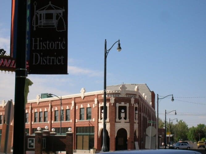
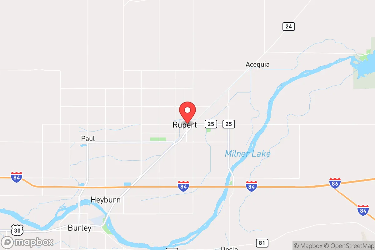
Strategic Assessment of Rupert, ID
Strong survivability profile. Good buffer from population centers, with manageable environmental and tactical risks.
What does the Strategic Assessment tell us?
Our Strategic Assessment grades tactical survivability of an area. Major population centers, military targets, fallout zones, natural disasters, and border exposure all drive risk — lower exposure means a more defensible position in a crisis.
This is heavily inspired by Joel Skousen's Strategic Relocation book. Highly recommended you checkout the book ($)What does this tell us?
Our Strategic Assessment grades tactical survivability of an area. Major population centers, military targets, fallout zones, natural disasters, and border exposure all drive risk — lower exposure means a more defensible position in a crisis.
This is heavily inspired by Joel Skousen's Strategic Relocation book. Highly recommended you checkout the book ($)Strategic Pillars

Key Distances
Regional Safe Places
Below is our recommended "safe zones" in Idaho and the surrounding area based on our strategic heuristics. For most people, it's unrealistic to live in a “safe zone” full-time due to work, family or other personal reasons. They tend to be more rural. However, many of these areas are perfect for second homes and retreat properties that double as a vacation home or even a short-term rental.


Important Note: For informational purposes only. This does not mean nothing bad ever happens in the green zones. Please use common sense. This is based on public data and modeled with AI. We tried to take a conservative approach but mistakes happen. We update this regularly as new information becomes available.
Solar Generator Recommendations
Backup power matters more here than in safer locations. We've picked three solar generators across budgets and capacity tiers — start with the budget unit if you only need a few essentials, or step up if you want to run a fridge and HVAC for days at a time.

Jackery Portable Power Station Explorer 300
Budget OptionPower on the Go: Weighing only 11 lbs, it's convenient to set up and store with book-sized foldable solar panels

BLUETTI Portable Power Station AC180
Designed for both indoor and outdoor scenarios, AC180 is highly capable as it has a robost capacity and continuous output power.

EF ECOFLOW DELTA Pro Ultra Power Station
Upgraded PickEcoFlow DELTA Pro Ultra is a whole-home energy system designed to grow with your family. Integrated with the Smart Home Panel 2, it scales to meet your evolving energy needs — keeping your home powered, intelligent, and secure through every stage of life.
We earn a commission, at no additional cost to you.
Strategic Assessment Analysis
Rupert, Idaho, offers a compelling strategic position for those prioritizing resilience and self-sufficiency, largely due to its location in the Minidoka County region of south-central Idaho. The area sits roughly 150 miles from the Boise metropolitan area and about 80 miles from the Pocatello-Idaho Falls corridor, placing it far enough from major population centers to avoid the immediate chaos of a civic unrest event or disaster, yet close enough to access critical supplies if pre-positioned. The Snake River Plain provides fertile ground and a reliable water source, while the surrounding agricultural infrastructure—including the Minidoka National Wildlife Refuge and extensive irrigation systems—creates a built-in food production network that most suburban or exurban locations lack. For a conservative-leaning individual or family assessing long-term viability, Rupert’s combination of geographic isolation, agricultural self-sufficiency, and low population density (approximately 5,600 residents in the city proper) makes it a defensible anchor point in an increasingly uncertain national landscape.
Geographic position and natural advantages for long-term survival
Rupert’s location on the Snake River Plain is its single greatest strategic asset. The area sits atop the Eastern Snake River Plain Aquifer, one of the most productive groundwater systems in the United States, providing a virtually unlimited supply of potable water for drinking, irrigation, and sanitation—a critical factor when municipal systems may fail during a prolonged crisis. The surrounding Minidoka County is dominated by farmland, with thousands of acres dedicated to potatoes, sugar beets, alfalfa, and wheat, meaning that food production is not a theoretical backup but an ongoing reality. The region’s elevation (approximately 4,150 feet) and semi-arid climate reduce the risk of flooding, hurricanes, and wildfire compared to coastal or forested areas, while the cold winters (average January lows around 18°F) naturally deter transient populations seeking refuge. The nearby Sawtooth National Forest and the Minidoka National Wildlife Refuge offer additional resources for hunting, foraging, and timber, though these should be considered supplementary rather than primary food sources. Critically, Rupert is situated away from major fault lines, nuclear power plants (the nearest is the Idaho National Laboratory, roughly 100 miles east), and interstates that would become chokepoints during an evacuation, making it a quiet, low-profile location that is easy to defend and hard to target.
Risks, exposures, and proximity to fallout-relevant landmarks
No location is without vulnerabilities, and Rupert’s primary risk stems from its proximity to the Idaho National Laboratory (INL), a 890-square-mile nuclear research facility near Idaho Falls. While INL is not a commercial power plant, it handles spent nuclear fuel and conducts reactor experiments, making it a potential target for sabotage or a source of radiological release in a major event. The prevailing winds in the region blow from the southwest, meaning that a plume from INL would generally move northeast, away from Rupert, but a shift in weather patterns or a secondary event could still pose a risk. Additionally, the nearby Mountain Home Air Force Base (about 100 miles west) could become a target during a conflict, though its distance and the lack of major military infrastructure in the immediate area reduce the likelihood of direct fallout. The Transcontinental Gas Pipeline (a major natural gas line) runs through the region, and a rupture could disrupt energy supplies, but this is a manageable risk with proper prepping. More immediate concerns include the potential for civil unrest spilling over from Boise or Twin Falls (45 miles west), though Rupert’s small size and homogeneous population (over 85% white, with strong LDS community ties) typically result in low crime rates and high social cohesion—a double-edged sword for outsiders who may not integrate quickly. The area’s reliance on agriculture also means that a prolonged drought or pest outbreak could strain local food supplies, though the extensive irrigation system mitigates this somewhat.
Practical resilience for a relocator: food, water, energy, and defensibility
For a relocator serious about self-sufficiency, Rupert offers a rare combination of immediate resources and long-term sustainability. Water is the foundation: the Snake River and the aquifer provide year-round access, and many rural properties already have wells or irrigation rights. A simple hand pump or solar-powered well system can secure a family’s water supply indefinitely. Food is equally accessible—local farmers’ markets, co-ops, and direct-from-farm purchases allow for bulk storage of grains, legumes, and root vegetables, while the growing season (roughly 120 frost-free days) supports home gardens for tomatoes, peppers, and leafy greens. The area’s agricultural surplus means that even in a crisis, barter networks would likely emerge around staple crops like potatoes and wheat. Energy is more of a challenge: Rupert is served by Idaho Power, which relies on a mix of hydroelectric, natural gas, and coal, but grid failure during a major event is a real possibility. Solar panels are a viable backup, given the region’s 200+ sunny days per year, and wood stoves are common for winter heating. Defensibility is where Rupert truly shines—the town’s layout is compact, with a grid of streets that can be easily monitored, and the surrounding farmland provides clear sightlines for miles. The nearest major highway (US-30) is a two-lane road that can be blocked or controlled with minimal effort, and the lack of dense forest means no cover for approaching threats. The local sheriff’s office and the strong LDS community (which has its own emergency preparedness network) provide a social safety net, but outsiders should plan to build relationships early to avoid being seen as a liability.
Overall, Rupert presents a strong strategic picture for a conservative-leaning relocator focused on resilience. It is not a perfect fortress—the proximity to INL and the reliance on a single industry (agriculture) introduce real risks—but its natural advantages in water, food, and defensibility outweigh most concerns. The area’s low profile, distance from major cities, and existing infrastructure for self-sufficiency make it a practical choice for those who want to be prepared without living off-grid in a remote cabin. The key is to act before a crisis: secure a property with a well and irrigation rights, build a network with local farmers and the LDS community, and stockpile supplies for the first 90 days while you establish your own production systems. In a world where urban centers are increasingly fragile, Rupert offers a quiet, sustainable alternative that prioritizes long-term survival over short-term convenience.
* Values derived from national, state, county, city and local statistics and may differ in a specific area. Last updated: 2026-04-21T09:13:53.000Z
Narrative content on this page is AI-generated and may contain mistakes. Verify any details that matter before acting on them.
ReloMaps may earn a commission from affiliate links at no extra cost to you.